
Hood River Waterfront
Hood River Waterfront
Tiffany George, Hood River Resident
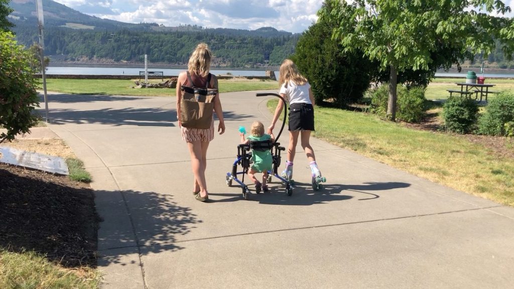
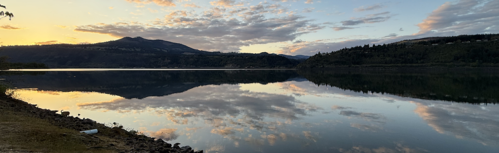
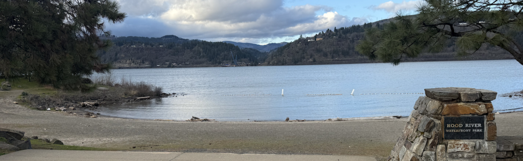
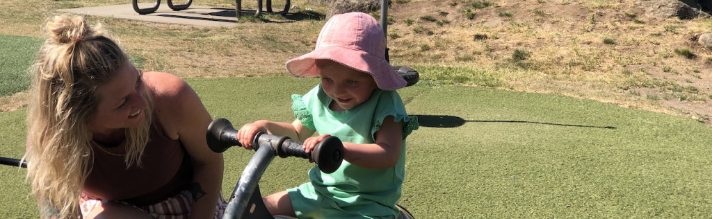
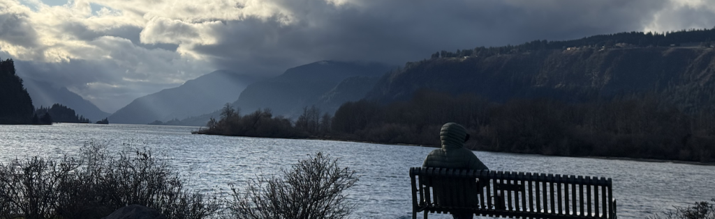
Hood River Waterfront has a 1 mile paved path that runs along the Columbia River with three popular spots along the way: the Hook with dramatic view to the West, the Waterfront Park in the middle with a beach and playground, and the Event Site to the East with a view of the bridge and wind sports in the summer.
Each area has 1 or 2 designated parking spots
The paved path is 8ft wide and flat
There are several benches along the way
The waterfront has two covered picnic areas with a 5ft wide path leading to each
There is an accessible water fountain near the playground
Bathrooms can be found at Waterfront Park and at the Event Site.
The Hook has 2 portapotties but neither are accessible
The path extends another mile further to the East along a sidewalk that leads to a bridge over the Hood River, past the Historic Museum, along the boat basin, under the Hood River bridge and along the front of the Hood River Hotel. This full extended path is 2 miles from the Hook to this point.
AUDIO STORIES: HOOD RIVER WATERFRONT TRAIL
Stop 1/Best Western Trailhead: All About Koberg Beach
All About Koberg Beach | Lisa Commander, Director, History Museum of HR County
The History of Koberg Beach | Lisa Commander, Executive Director, History Museum of Hood River County
Welcome to Koberg Beach. Long before Hood River was known as the windsurfing capital of the world, this shoreline was shaped by work, water, and access. An early road followed the riverbank here and in 1894, John H. Koberg, an immigrant from Germany, purchased 120 acres east of Hood River near Stanley Rock, the prominent rock formation upriver.
The land became a truck farm, also known as a market garden, that grew asparagus, peaches, and tomatoes for Portland and local markets. By the 1910s, it had also become a popular picnic spot for families drawn to the river. Improved access transformed the area along the river.
In 1921, the original Columbia River Highway opened. Dynamite was used to carve through basalt cliffs and tunnels to create one of the northwest’s scenic automobile routes. Coburg Beach was suddenly easy to access and its popularity grew quickly.
A year later, Koberg built a rustic stone pavilion that included a shooting gallery, picnic and cooking areas, a concession stand, and a dance floor. Popularity of Koberg Beach reached its peak on July 4th, 1925 when it hosted one of the largest celebrations in the region. Newspapers reported as many as 10,000 people were expected for a full day of speeches, games, fireworks, and even a woman’s nail-driving competition.
The highlight was the debut of a new open-air dance pavilion. Contemporary accounts called it the outstanding feature of this year’s celebration, praising its open sides, broad verandas, and sweeping views of the Columbia River from beneath Stanley Rock. The pavilion became Hood River’s social center for nearly two decades.
Change came with the river itself. After the completion of Bonneville Dam in 1938, the water level of the Columbia River rose permanently, submerging most of the beach. Seasonal flooding made the pavilion unsafe.
In 1951, the federal government purchased the property for freeway construction and the structure was demolished. The scenic highway that wound its way over and through the Columbia River’s basalt cliffs was bypassed by Interstate Highway 84. The new route followed the riverbed in a more efficient and direct manner that reflected the abilities of 1950s cars, as opposed to the Model As and Model Ts that had once followed the Columbia River Gorge in a more leisurely manner.
In 1997, the area became Koberg Beach, Oregon State Park, where recreation and fishing now share the shoreline. This stretch of river was designated an in-lieu fishing site, preserving the treaty-protected access through fishing platforms that are still used today. The dance floor is gone and the beach itself lies underwater, but the river remains central to this place.
Koberg has always adapted, shaped by farming, celebration, transportation, and continuity, and its story continues along the Columbia River today. Thank you for listening. My name is Lisa Commander and I am the Executive Director of the History Museum of Hood River County.
We are located at the confluence of the Hood and Columbia Rivers. Come visit the museum to learn more about our community.
Stop 2: The Singing Bridge
The Singing Bridge | Gretchen Goss, Port of Hood River
For most of its history, the Columbia River was not a barrier dividing communities, it was the route connecting communities. People, goods, and ideas moved along it, navigating rapids, spring floods, and even ice when it froze over in the winter. Long before steel spanned the water, ferries stitched the gorge together, carrying passengers, cars, and goods from one shore to the next.
By the 1900s, ferries like the Panama were essential transportation infrastructure along the river. O. C. Commodore Dean had been running ferries since the turn of the century, and legend has it that one particular cow crossed the river daily under his watch, heading to fresh grass on the opposite shore. Dean and his stepson, Alf Shepler, moved whatever needed moving, cars and carts, crates of fruit, people bound for work or home.
By the 1910s, life along the river was changing fast. Automobiles rattled in by the dozens. Telephones rang.
Electricity hummed. Diesel ferries replaced sail-powered vessels. When the Columbia River Highway opened, cars poured into the river.
As car travel gained popularity, the river became more of an obstacle as crossing from one shore to the other presented new challenges. The slow ferry suddenly became a bottleneck. A round-trip crossing could cost as much as two dollars, a small fortune at the time, about sixty dollars today.
Eventually, inconvenience gave way to ambition. Led by Hoodover businessman Leslie Butler of the Butler Bank, farmers and businessmen raised money through the purchase of subscriptions, buying shares in the bridge that would ultimately end the need for the local ferry business. On the new bridge, cars could cross for just 75 cents and hungry cattle for just 10 cents a head without having to wait for the ferry to show up.
On opening day in 1924, 1,500 people attended the celebration, crossing by foot and model Ts for the first time with ease. Mayors from Oregon and Washington met in the middle, shook hands, and exchanged wooden crates of fruit, marking not only a transportation milestone but a shared agricultural and economic bond. My name is Gretchen Goss, a local writer and consultant for the Port of Hood River, who grew up in the beautiful Hood River Valley.
As a girl, I remember driving across the bridge to Washington and humming along as it sang beneath us. We called it the Singing Bridge, its sound rising as tires moved across the metal grates, a sound that was later silenced by necessary welding upgrades. For over a century, the Hoodover White Salmon Interstate Bridge has carried millions of vehicles and anchored daily life in the gorge.
In 2024, that legacy was reaffirmed when mayors and commissioners reenacted the original handshake at the Centennial Bridge celebration, and more than 4,000 people stood together on the bridge, honoring a century of connection. The bridge reflects a bygone era, and with more than 3.6 million vehicles crossing each year, the time has come to look towards the future. As the communities along the river have grown and changed, so have their transportation needs, and the time has come for the historic bridge to be replaced.
Once again, communities on both sides of the river are coming together to make it happen. The proposed replacement bridge, designed to improve safety, navigation, and multimodal travel, bikes and pedestrians will be able to cross, will carry forward the deeper purpose this crossing has always served, keeping communities on both sides of the river connected in changing times for generations to come.
Stop 3: Dynamic Forest
Dynamic Forest | Doug Thiesies, Hood River County Forestry Department
From about 1890 to 1930, much of the forest land in Hood River County was either settled by homesteader claims or logged by timber companies in the cut-and-run days when there was not much regulation in the forest industry. Most of those who tried to settle and make a living on the homesteads found out that the cooler, higher elevation conditions made it very difficult to make and sustain a living. After the homesteads failed and the company logging clear-cut the majority of their land holdings, much of this forest land fell into tax foreclosure.
In the 1940s, Hood River County decided to designate the foreclosed forest land as county forest rather than deed it to the state like many other counties in Oregon did, which created various state forests on the west side of Oregon. By doing so, Hood River County retained local control over the county forest, with the intent of managing it for revenue to support county services. The forest grew back sufficiently, even without planting, and by the 1970s began to make a noticeable difference in contributing sustainable revenue for county services.
There were also benefits to local jobs, the economy, and building material supply. For example, from the 1990s and to the present, the county harvest is enough to build over 300 homes per year. Since its designation, the county conservatively manages the forest for sustainable timber harvest, which provides revenue to the county general fund.
To do this, county forestry staff continuously maintains an inventory of the timber, conducts reforestation, complies with Oregon forest practice regulations, and follows a certified tree farm management plan. This results in a non-declining even flow harvest that amounts to approximately 1.1 percent of the county forest land each year. By the 1990s, recreation demand began to increase in the county and on the county forest.
User-made trails became more popular to the point where the county needed to find out if there is a way to allow recreation trails and still continue managing the forest for sustainable revenue for county services. In 2004, the county commissioners adopted an ordinance which allowed for creation of a dynamic multi-use trail system on the county forest, while prioritizing the sustainable harvest of timber from the county tree farm to help fund county service. The trail system is exceedingly popular with locals and visitors and continues to be expanded and enhanced.
Over the last 30 years, the county forest contributes about 30 percent annually to the general fund. I’m Doug Thiesies, forestry director for the county forestry department. You can find out more about the county forestry department and forest recreation opportunity on the Hood River County website.
Stop 4: Fish Wars
Fish Wars | Buck Jones, Columbia River Intertribal Fish Commission
Yeah, my name is Buck Jones. I’m an enrolled Cayuse tribal member, one of the bands of the Confederated Tribes of the Umatilla Indian Reservation, and for the past 21 years I’ve been employed with Columbia River Intertribal Fish Commission. You know, later in our history was some of the fishing wars that happened with our tribal members.
There was both in the Puget Sound area and then the Squally River, with Patway Billy Frank, you know, was a leader of fishing, you know, fishing for people using those treaty rights that, you know, that this was, this is something that was, you know, granted to us and got arrested quite a few times or whatever, you know, by the states. And at the same time this was happening down on the Columbia River at Cook’s Landing with the Sohapi family and some different tribal members from Yakima, in the same sense, you know, this is our treaty fishing right, where fishing was our right, you know, to fish. And, you know, they got arrested as well and served federal prison time to uphold our treaty fishing rights, you know, that is a really important part of our history, you know, that they, you know, sacrificed you know, time in federal prisons that, you know, that kind of in a way was unjust or whatever, but it is part of our history and that is, you know, something that I think a lot of our tribal members, you know, they know, but there’s some people that do not know about these battles that we’ve had, you know, that these people have had or whatever, you know, and it wasn’t, um, and so that really was really an important piece, you know, and that was some of, you know, through some of the treaties that was signed that they was able to, you know, to uphold, like I say, just go do fishing like that, that was promised by the U.S. government.
Our commercial area, you know, is like I said, it’s called Zone 6 and it’s a reserved right, from the treaties that, you know, that’s where the four-member tribes can fish and that’s 147 miles between Bonneville Dam, it starts at Bonneville Dam and goes all the way to McNary. A key decision, you know, was the Bolt decision by Judge Bolt who upheld the tribes were allowed 50% of the harvestable catch of the species and that was system-wide, you know, and system-wide meaning like all the tribes in the Puget Sound and in the Columbia River were allowed 50% of the catch of this, whether it be shellfish or whether it be salmon, so that really was a real key moment and the tribes were fishing, you know, regulations.
Stop 5: This is Who Our People Are
This is Who Our People Are | Toby Patrick, Confederated Tribes of the Umatilla Indian Reservation
My name’s Toby Patrick. I’m a board member at large, board of trustees for the Confederated Tribes of the Umatilla Indian Reservation. Well, it took us a while.
Where are we? We’re in the Sawtooth. The Sawtooth, we’re at Cold Springs. Cold Springs? Yeah, Indian Camp’s right over there.
Then I know where I’m at when she says Indian Camp. Okay, alright. So I guess we’re up here picking huckleberries.
So you get out, open the door, and the first thing you smell, oh my God, you smell the huckleberries. I’m in the huckleberry fields. This is beautiful stuff up here.
I mean, you just remember everybody’s favorite food, right? I mean, the wíwnu, the huckleberry. The last food on our table to serve in our order of our traditional foods. And a certain time we get to eat it on our table too.
As soon as a man with the bell or whatever in charge hollers out, well, oh no, and then now you get to eat your huckleberries. Now it’s time for everybody to enjoy. But now it’s gotten to the point where kids and everybody just loves huckleberries.
They look at it, it’s on the table, eat it. I sit there and people look at me, and I’m the kind of traditional guy. It’s like, hey, hey, hey, leave those alone.
But it’s on the table. But that guy didn’t call, wíwnu yet. And of course I’d take, when you get to a feast or whatever, they got apple pie and they got cake, whatever.
I’d be sitting there with my apple pie and my cake, but I wouldn’t touch it until the man said, wíwnu, because he’ll ring the bell, gading, gading, gading, gading, wíwnu. Oh, now you get to take it. But there’s some places where they don’t do that, and the kids will eat it before it’s time to get to that part.
Those teachings that we’re losing, those little Indian laws, those little unwritten laws that mean something to Grandma and Grandpa when I was growing up, what do they mean to me if I don’t speak up on them? And what does that make me in my society or my people when I do speak on it when nobody else carries it? My gramps told me that. We had the ability, number one, you got to learn how they think. You got to understand how they do things, because they don’t do things like us.
These people have a way of doing things, and if you understand their way, you can make things like this happen. What I’m trying to tell you is that you got to learn to grow up in society and not forget who you are, number one. Never forget who you are, but educate yourself.
Get some knowledge in what’s being done in society, because society is going to move and move and move and move, and you’re going to be like this. And they’ll get further ahead, but ascending people will still be chugging behind. And eventually it’s going to come to a point where they’re going to get too far ahead, and they’re going to turn around and look, and they say, we need this.
We need to follow the Indian way. We need to do what the Indians do. How did the Indians do it? There was so much buffalo, there was so many horses, there was so much animal, there was so much salmon in the river, all of the fish that we had, all of these abundances of food that was just kind of taken.
The dams go up. Oh, man, there goes our fish run. It stalls our čúuš.
Now our čúuš has a problem. Oh, man, all of our water. So I sit there, and I look at it coming down, and I was like, man.
So my gramps had to go through and do all of this, learn how to become a young man out of Palouse Falls area, the Palouse River, where he grew up. I was a young man running up and down the Palouse River. And then when they had that, some kind of act in the 30s or 40s, something he says, and I’m sitting there listening to him.
And we had to go to a reservation in order to be recognized. My grandfather told me that this is who our people are. So I had family that got sent to Colville.
I had family get sent to Yakima. Me and my family got sent down here to Nixyáawii . And I had family sent over to Nimiipuu, the Nez Perce.
So you’ve got to understand, your family is all of that. And I sit there listening to my gramps because he talked about the, I believe it was the 1934 Indian Relocation Act. So that was at the moment where they wanted all of the Indians off the usual and accustomed lands and on a reservation or you will not be known as a native.
So all of my gramps and his people were sitting there and we had to acknowledge the fact that society’s moving. You remember who you are and where you come from because they’re going to need this later on. Okay? All right.
So all of these things that I’ve been able to share here today is just by that order that we have. It’s the same order as our food, our fish, our meat, our roots and our berries. It’s the same thing as mom, dad, your kids and grandkids, gramps and grandma, your brothers and sisters and your kids.
And the way that I look at it is, you know, the grandkids or the kids or that generation is always the wíwnu,, is always the sweetness of you. They’re the sweetness of your people. They’re the beauty of what you want to have, carry on the rest of that table.
When you think about those teachings, when you think about those things, some of the unwritten laws that we don’t share with the younger kids, why we have the wíwnu,, why we have our younger people and why we hold it like that, why we are the way we are with our čúuš. along with our elders, maybe our mom and our dad for the meat and the salmon, the fish, those things there and how they all unfold because they all mean something in our life. They all have a standing. They all have a life that they live and when their end comes, it ends up on your table for you to carry it on, for the next generation to carry it on.
Stop 6: It's Called Windsurfing
It’s Called Windsurfing | JerryAnn Devlin, Windsurfer
My name is Jerry Ann Devlin. When I became a late adult, I had to make a choice where I was going to live, and I had a friend that lived on Vashon Island up out of Seattle and visited him one summer with the family, and he had this crazy looking piece of something in his yard, and I said, Fred, what’s that? And he said, oh, that’s something new. It’s called a windsurf board.
I said, what? He said, come back tomorrow, and I’ll show you. We’ll put it in the water, which I did. Very hard, very difficult, and he is short, one-handed with a bear in one hand, and he’s doing it just fine, and I couldn’t stand up in the thing.
My brother was with us that summer, and I got off the island, headed back for Southern California, where I had raised my children, or was raising the children, and I said to my brother, I got to have one of those. I got to have one. Turned around, went back, went back to the island, and bought a windsurf board, which I still have in the backyard.
So that was the beginning of my windsurfing here in the gorge, I’d heard about this place up in Oregon. They didn’t have a name for it, and there still is no name for it except the gorge, and that’s no name. It’s a description, but anyway, I came up here one summer and met my friend that I got the board from.
That was in 1981. Bill Klein is no longer here, but I got a job in the store, a sporting goods store, and I learned to windsurf. I wish you could say I really learned, but I started windsurfing.
It’s probably the hardest sport there is. Skiing’s hard, too, but it’s not as hard as windsurfing. I was the first woman certified ski instructor in the east coast, so I had learned to teach, and I was working for Bill.
People here in Hood River were starting to get very good at windsurfing. Not such a choice of sails, but because we had a variety of wind here, they learned that they could build larger or smaller sails to accommodate the wind. The windsurfing business really boomed here.
They always have wind, and the river is safe. You’re not going to get blown out to sea. There’s two shores.
There’s a road on each shore. I’ve had to hitchhike more than once to get back to Hood River as a lot of people, and it’s safe. There’s a lot of people that look out for each other, and you can find gentler wind in various places.
You can find high wind like the hatchery, or you can find lower wind here in Hood River proper in a few different places. The hook, and then Rhonda Smith, who was a world champion from Florida, and she decided that this was going to be a good thing, so she opened up a shop and a teaching site, and her teaching site was right at the bridge, but the launch isn’t good, and a lot of people have learned over the years the inside where the boat basin is. Well, the people that are storing their boats used to complain because you’re putting a beginner in there, and they couldn’t steer, and they’d run into the boats and do damage.
That happened with Rhonda. They complained to her not to put her beginners in there, because I taught for her there also. The sailing site at the marina there is non-existent.
We had that flood come down from Hood a few years ago. It brought a lot of silt and timber and stuff down with it, and filled in that whole cove, so it’s no longer sailable. No longer sailable.
You can walk way out in the weeds and have grown up. I discovered the hook. But it was a ways out of town, a little bit hard to get to, but I talked Rhonda into She had a truck, an old beat-up little old truck, to taking some boards, windsurf boards, to the hook to test it out and see how it… Well, it was perfect.
Absolutely perfect. On the outside, the wind will blow you right back to the land, and the inside is quite shallow, and it’s safe as all get out, and it was not intimidating for beginners. That was the best beginning sailing site ever.
I am no longer teaching. I’ve learned to drink a lot of beer, and I like that pretty well, too. Meet different people, lots of sailors, lots of skiers, and that’s about all.
Stop 7: Yellow Rumps & Red Wings
Yellow Rumps and Redwings | Miko Ruhlen, Birder
My name is Miko Ruhlen. I’ve spent many years of my life out in the field watching, studying, and working to conserve birds near beaches and waterways. Many might view the shoreline and river as a recreation area, but as a former field biologist, I see this place differently.
When I look over Nichols Basin, I see essential habitat. Nichols Basin is home to countless interesting creatures who base their survival on this place for food, water, shelter, nesting, and resting areas. During the winter months, you might see a gathering of roosting Black-Crowned Night Herons in the trees, or you might hear them.
They look similar to great blue herons, but have a shorter neck and appear stockier with short tails. Adults have a dark cap and bluish hue to their feathers, but it takes three years for these birds to attain this plumage. Younger birds are brownish with white streaks.
These social birds generally stay together in groups to rest here in winter and then migrate eastward to their nesting grounds near Malheur Lake for the spring and summer. Nichols Basin has been a unique and rare winter gathering area in the Columbia Gorge for this species. Bald Eagles are another bird that gathers and roosts in large groups along the Columbia Gorge in winter.
In spring and summer, Osprey can also be observed hunting and carrying fish over Nichols Basin and the Columbia River during their nesting season. You might see them circling and screeching and possibly carrying a fish or a stick during a courtship display called the Sky Dance. Osprey are smaller than Bald Eagles and have a white head with a dark eye stripe.
Both the eagles and osprey have made a great population comeback since the ban of the chemical DDT in 1972. I am a shorebird fan and I love seeing breeding Spotted Sandpiper and Killldeer here along the shore. Despite all the recreation activities that happen here and along the Hood River Spit during spring and early summer, these wild birds still manage to nest right in the sand or gravel, hatch their camouflaged eggs, and tend their flightless chicks until they’re able to fly away.
If you look to your right at the southern edge of the basin, there is a restoration area called Nichols Natural Area that protects native habitat. Trees and shrubs planted here by volunteers and maintained by local organization Columbia River Keeper improve water quality and provide habitat for insects, birds, and other wildlife. Listen for Song Sparrows, White-Crowned Sparrows, American and Lesser Goldfinches, Yellow-Rumped Warblers, Red-Winged Blackbirds, and more.
This restoration area also helps water birds with places to hide along the shore in the brush. My hope is that we can all continue to improve and share the habitat with birds and wildlife here at Nichols Basin and the Columbia River. If you or a pet are too close to a nest or eggs, adults might call out or fly back and forth in distress as an alarm call.
You can keep your distance while enjoying the birds and scenery. Birds that are feeding or resting after migrating long distances also need undisturbed time for these survival activities. You can keep the water cleaner by picking up some litter.
We can leave this place a little better than we found it. Thanks for listening.
Stop 8: Nichols Boatworks
Nichols Boatworks | Rodger Nichols, Hood River Resident
Welcome to Nichols Landing. I’m Roger Nichols and my family name is tied to this property through a pioneer business once located here, Nichols Boat Works. The company operated for 57 years, from 1941 to 1998.
During that time, the workers built more than 350 boats and barges of all descriptions, and it owes its beginning to a fire and a foreclosure. The fire took place on a boat owned by my great uncle Luke, longtime river man of the Columbia and Willamette. It was the tail end of the depression.
Grandpa’s apple orchard near Zilla in Yakima Valley was foreclosed. So when his brother Luke asked him to come help rebuild his boat, this time with a steel hull so it wouldn’t burn, he took the offer. It took the two of them just three months to build a 30-foot boat on a temporary ways on the Washington side of the Columbia.
Before they finished, they were asked, can you build one more from scratch? And a business was born. They bought a foreclosed piece of land on the Oregon side for $500 and $100 a year. Back then, the property sat on what was called the mole, accessed by an extension of First Street.
Highway 30, now the route at I-84, had just been built, and everything north of it was mudflats and river. The land you see today was added in the 1950s and 60s through the Port of Hood River dredging and fill. Over the years, my three uncles worked in the family business, as did my father.
The uncles went their way one by one, and my father stayed and took over operations when my grandfather died. Over time, the boat works moved twice, first when Arco bought the original site, now the gas station, and later to the location now occupied by the medical building and hotel. During World War II, when many other boat builders were turning out large craft for war purposes, the boat works built tugboats, barges, and fishing boats, working craft.
Though tugboats and barges were the company’s bread and butter, it didn’t stop them from working on other craft. In the 1950s, they built boats that were jet-powered. The crowning glory of the built was the Sternwheeler Columbia Gorge, which has an odd origin story.
The Port of Cascade Locks, 20 miles west of Hood River, wanted to build a tramway up to the top of the ridge, which would offer a magnificent view of the Columbia Gorge. But many people thought that the tram would spoil their view. The project was killed.
Senator Mark Hatfield, that already got the money appropriated, was able to switch it to a different tourist project for the port, and two and a half million dollars later, the Sternwheeler Columbia Gorge became the first on the Columbia in decades. It launched at Nichols Boatworks in 1983, and it’s been carrying tourists to this day. It’s a point of personal pride that dozens of tugboats built by Nichols Boatworks are still operating up and down the west coast.
Ultimately, the boat works’ demise traces to cutbacks in the forest products industry. Fifty percent of our clientele was wood products related. That included boom boats, which dealt with logs and mill ponds, and tugs pushing barges hauling wood chips, newsprint, and supplies to make paper.
We had a lot of very good people work for us through the 57 years. If we put a lot of bread on their tables, they put a lot of work into our boats, and we’re proud to share the heritage. Thank you for listening.
Share the heritage.
Stop 9: Mountains Fighting
Mountains Fighting | Toby Patrick, Confederated Tribes of the Umatilla Indian Reservation
My name is Toby Patrick. I’m a board member at large, board of trustees for the Confederated Tribes of the Umatilla Indian Reservation. My grandpa talked about the mountains.
You see those big mountains down there? He sits there and he starts telling me about these big mountains. And there was a time when they started arguing with each other. And they’d fight and get mad.
And they’d do this. Then they’d quit for a while. They’d settle.
The other one had seen it and started doing the same thing. Match them. Next thing you know, this one’s getting jealous, so he’d match them too.
These mountains were fighting amongst each other and started saying, see this? If I do this, it makes me bigger and more beautiful than you. They’d do it again. This mountain, do it again.
What he was talking about was they were exploding, volcano, building themselves up, building the earth. The earth was building itself up, up in this area, in this country. And all of the mountains were arguing.
Mount Adams, Mount St. Helens, Mount Rainier, Mount Olympia, Mount Hood, Jeffersons, all of them, they’re all arguing with each other, fighting. Well, the salmon would come up a little ways and they had to turn around and head back. They couldn’t come any further because the lava was ruining the water.
All the animals that was in that area, Spilyi was way over there and he was talking to a Roosevelt elk. What are you doing here? Shouldn’t you be home? Can’t. Can’t be home.
Mountains are fighting. We have no more place. There goes the mule deer, hopping across the plains.
And Spilyi, coyote, was watching. He said, what are you doing? You’re supposed to be up in the mountains. There ain’t no mountains for me.
Those people are crazy. He took off, ran some more. Scared.
Okay, so the elk, the salmon, and the deer told me they can’t go home, so I guess I better go check it out. So way, way over there on the other side of the United States, he started running. And dark time comes and he could see this big old glow over here on the side, like when you’re going into Portland or something and you see the nightlight.
That’s what he’s seeing and it was just the mountains. All of our mountains here. He got pretty close to the mountains and he could talk to the mountains and he told the mountains, you guys better knock it off.
You guys better quit fighting because you guys are ruining the land and your people can’t eat. They can’t survive where they’re supposed to. They stopped and looked at him and said, you’re a little man.
Get away from me. And so they proceeded to fight. Spilyi, I sit there, he walks off and he’s like scratching his head.
I don’t get it. I’m supposed to help the creator. I’m supposed to be the creator’s right-hand man, but these guys ain’t listening.
I’m going to get in trouble. I’m going to have to do it. I’m going to have to do it.
So he made a call to the creator and he didn’t want to do it, but he had to call and creator looked at him and says, you got to reach out. What’s going on? I’m having a problem with the mountains, the elk and the deer and the salmon, the birds of our people can’t go home because the mountains won’t stop fighting. They keep talking about making themselves look bigger and beautiful than the other and they’re destroying that land.
That’s why I put you there. Yeah, I know, but they’re not listening to me. Okay.
Well, you tell them they got to get it handled or I’ll take care of it if they can’t. Okay. So the Spilyi, I come back down.
He stopped and told the Yamish that I spoke to creator. I’m going to go talk to the mountains. They got to take care of this or he’ll do something about it.
So be prepared. I don’t know what it’s going to be. He told that to the elk.
He told that to all the animals, the yucca, the bear. He’s telling all of these animals what’s going on. So I spoke to creator.
The creator said the mountains got to stop or he’ll fix it. I got to go down and tell the Nusuk down there, Wiconish. I got to go down there and tell them.
So he made his way by here, go through, get down to the ocean. He tells the salmon that you’ll be able to go home pretty soon. The mountains got to talk to each other and work it out.
The creator said just to prepare. I don’t know what he said he’s going to fix it, but he’s going to fix it if they don’t. So then he come back and he told him that.
But before he went, that’s right, before he went down to go see the salmon, he told the mountains, you guys better stop fighting. The creator is going to fix it. If you guys don’t fix it, I’m going to go tell the salmon when I get back, I want an answer.
So he did. He went down, told salmon and he come back. He got back and they’re still fighting.
Nobody wants to listen to him. They’re destroying all of this land. You can see it on some of these mountains here where it’s Angle Basalt, Column Basalt, and they have this, you can see the way that it’s layered, that the lava along the gorge here.
And Spilyi, I tried to tell them and they wouldn’t listen. So then he told the creator, he says, they’re not listening. And the creator says, well, you tell everybody to hunker down.
I’m going to fix this. And so he came down and he told the mountains that you guys got to quit. Because if you don’t, I’m going to put some, I’m going to blanket you.
And you guys are going to be the only ones to have this blanket. Everybody will get it, but you’re always going to wear it. And they sat there and they got quiet.
Okay. The creator says, okay. They tried it again.
The little ones. Still. Okay.
Then the Ice Age came. That’s when the Ice Age came and hit. The crater blanket everything in this world was snow.
Covered it all. Because those mountains were fighting. They couldn’t get it together.
And he needed to calm them down and show them that I am the one who says that you’re beautiful. I’m the one who puts you there not to fight, but to be together for those around. So then he told that to the mountains.
And then when the Ice Age, when it came time to dissipate and all of that, Spilyi, I told all the animals be prepared. So they were. They were in the areas where they wouldn’t get washed away when it came time for the big thaw.
When the gorge was created even bigger into the Columbia Gorge, into the Snake River. All of that, what they call the Mount Mazama floods up there in Montana. That’s because of what the creator did in helping us down here.
In doing so, our mountains still have that cap of snow to remind them that, yeah, you’re beautiful. This is your cap. This is the creator’s cap.
And out of everybody here on this earth, you’re the only one that wears it like that. So you’re still beautiful. And people will see you from a long ways and look at your beauty.
Stop 10: Inventing the Kite Ski
Inventing the Kite Ski | Cory Reiseler, Kitesurfer
So if you’re in Hood River and you’re looking out at all these wind enthusiasts getting towed around on various things, let me tell you about the history of kiteboarding. So my name is Cory Roeseler, I’m from Seattle, Washington, actually a small town called Kirkland, Washington. My father, Billy Roeseler and I co-invented kite ski, which became kiteboarding in the late 1980s.
My dad was a MIT trained engineer that worked at Boeing and had this idea that we could tow a boat with a very large kite. And in 1979, he published a paper that said, we can sail four times wind speed, go 40 knots with 10 knots of wind by towing a hydrofoil with kites. We had some trials in the 80s that were kind of hit and miss with large kites with the pilot up in the kite in Lake Washington.
And then it started working in 87, in Straits of Juan de Fuca and then down in the gorge where we’d stack up small kites and tow me, I was the test pilot on water skis. That evolved into a business called Kiteski. In 1992, we incorporated that down in San Diego, but pretty quickly discovered there wasn’t enough wind in San Diego.
So in 1994, we moved to Hood River, continued to develop the sport of kiteski. My wife, now of 31 years, Therese was the first female kiter in the world. She and I made two beautiful baby boys that also became kiteboarders.
And we got to travel to Europe and New Zealand and Morocco and introduced the sport of kiteboarding to the world. In 1998, we organized the third annual world championships, ended up being in Maui. And the Maui guys really were better at us at making it look cool, kite surfing on waves and the sport just took off from there.
Yeah, so the big turning point probably from a performance standpoint was in 1989, there was an annual downwind race called the Blowout from, and then those days it was Cascade Locks to Hood River. It changed to Stevenson to Hood River, but when 190 windsurfers launched from Cascade Locks and raced to Hood River, and I launched and started last and passed every single one of them, it put kiting on the map. It really turned some heads and demonstrated that kite ski, which became kiteboarding is the fastest way to sail downwind, especially in the gorge.
So we set out to set the world speed sailing record and my dad and I didn’t actually do it, but Rob Douglas did with a kiteboard. He broke the, he smashed the world speed sailing record and demonstrated that kiteboarding is the fastest way to sail, period, 500 meter course. After Rob smashed the record a couple of times, another trimaran contraption came along and beat his record.
So kiting is no longer the fastest, sail rocket is, but there was about 10 years where kiteboarding held the world record. The proof that my dad was right in 1979, you can sail four times as fast as the wind by towing a hydrofoil with a kite. Yeah, so winging is kind of this next trend sport that has made kiteboarding decline because a lot of people getting into the sport or water sports enthusiasts are changing over to winging.
I love it. I think it’s just another fun way to splash around in the water. I still prefer kiting because you can, the explosive power is just, I’m still addicted to that drug where you can, you can dive the kite from 100 feet to 20 feet and get a huge burst of power, either to get up on a plane or get flying on the hydrofoil or boost a huge jump and do a kite loop.
So I’m probably gonna stick with kiting for now.
Stop 11: Wind is a Big Deal Here
Wind is a Big Deal Here | Mark Nelsen, Weatherman
Hey folks, it’s Mark Nelsen. I’m a meteorologist and I just happen to live right here in the gorge, so let’s talk weather. First, the wind.
Now, as you move through the gorge, whether by car, bus, bike, or unicycle, whatever transportation you’re using, you’re going to notice the fir trees point one direction or another depending on where you are. You know, I’d show you a picture, but well, you know, this is just audio, so you just have to trust me. Branches only grow on one side of the tree and the side facing the wind is bare.
It’s kind of a natural flag, let’s say. Now, that’s because the wind is almost always blowing somewhere in the gorge. Now, in the summer, it’s a westerly wind that blows from Cascade Locks and Stevenson out to the Dalles, but in the cold season, a fierce and cold easterly wind blows from Cascade Locks and Stevenson all the way down to Portland, and in fact, before I-84 was built, trucks passing around Crown Point up near Corbett, Vista House, they would sometimes tip over due to those 100 plus mile per hour wintertime gusts.
Now, at least that wind does help freeze the waterfalls at times, and that’s one positive. They are beautiful if you’re here that time of the year. Now, you know, trucks have also tipped over on the Maryhill Bridge east of the Dalles from those warm season westerly winds, so wind is a big deal here, but there’s no need to get into a deep meteorological discussion.
You know, this wind thing is just due to pressure differences across the Cascades. Air is always trying to move back and forth through the gorge to equalize those pressures. Okay, I guess that was kind of detailed, but anyway, of course, this is why wind sports are so popular here in the Columbia River Gorge.
This area is a world-class windsurfing and kiteboarding destination. All right, we covered wind. Let’s talk about the rain.
As you travel east through the gorge, Troutdale averages about 40 inches of rainfall each year. By the time you get to Bonneville, it’s about 90 inches, and this is what we call the waterfall corridor. It’s a rainforest, a temperate rainforest.
That’s because the gorge cuts through the Cascades, and those mountains force clouds to drop tons of rain in the western gorge as specific weather systems move inland, but then as those weather systems move east, the rainfall drops off dramatically as you head out towards the Dalles. In fact, the Dalles only picks up about 15 inches of rain a year, not even enough to sustain trees. You really notice it as you’re driving eastward.
Well, of course, if somebody waters the trees, there can be trees out there, but typically you don’t see them. Now, this is one of the few places where you can drive from rainforest to desert-like conditions in just a one-hour drive. Thanks for listening.
Enjoy the rest of your visit to the Columbia River Gorge.
Trail Safety Text
Trail Safety | ReadySetGorge.com
Stay on the trail
Mind the poison oak
And ticks along the way
Don’t want to provoke
Stay on the path
To keep those species at bay
They cling to your shoes
Don’t let them stray
Welcome to the gorge trails
Say hello to all,
wag those tails
Because everyone is welcome on our Gorge trails
Keep your dogs on the track
For the same said reasons
Let’s protect this place
Through all the seasons
Leave the flowers be
Just take memories home
Photos in your heart
Or on your phone
Welcome to the gorge trails
Say hello to all,
wag those tails
Because everyone is welcome on our Gorge trails
This place is unique
No other alike
Stop by the next town
For a drink or a bite
They say leave no trace
Pack it in, pack it out
Or simply put
Take care on your route
Welcome to the gorge trails
Say hello to all,
wag those tails
Because everyone is welcome on our Gorge trails
Slow Hiking Text
Slow Hiking Scavenger Hunt | Emily Martin
Hi, I’m Emily Martin and I’m going to be your slow hiking guide today. And slow hiking is a form of mindfulness in nature, where really the journey is the destination. We’re not necessarily trying to get through the entire trail or race up the hill or reach a goal.
The goal simply is to be present, to have fun and enjoy this beautiful place. Today we are at Catherine Creek and for our slow hiking experience here we’re actually going to do a scavenger hunt. This is a bit oriented towards younger people, perhaps ages 4 to 12, but adults feel free to join in and experience the magic of nature.
Please let your child know that there’s no picking of flowers or collecting of any objects during the scavenger hunt. So it’s more of an experiential scavenger hunt in the moment. We’re not trying to collect anything.
Let’s take three breaths, breathing in through our nose and out through our mouth. And as you breathe out you can just give a big sigh and it can be loud, almost like a lion’s roar. Good.
We’re going to start our journey by going to the right. So if you’re at the main Catherine Creek kiosk we’re going to follow the trail to the right. And anytime there’s an intersection just stay to the right.
So we’ll basically be doing the outer loop of the paved area of Catherine Creek. So what’s fun about doing these slow hiking audiophiles is I don’t know what season of the year you’re coming. And so this can be a more or less challenging first scavenger hunt task depending on the season you’re in.
But here it is. Your first task on the nature scavenger hunt is to look down at the color of your shirt, whatever the dominant color is, meaning the color that’s mostly on your shirt. So most of your shirt is this color.
I want you to now find something in nature without picking it, just finding it, something in nature that matches the color of your shirt. And once you have that I want you to show it to your parents. I’ll just give you some time right now so you can keep the audio recording going.
If you’re having trouble finding something on the ground don’t forget to look in the sky. Look at the trees. There’s wildflowers.
Look at the colors of the flowers. You can look underneath leaves or at the base of the plants to find more colors. I’m going to give you another minute to find the color in nature that matches your shirt.
And if you need more time than a minute you can always pause the audio file. Good job. Okay, if you haven’t found the right color you can pause the audio file and keep looking.
If you have found the right color, great job. Show one of your parents or your friends and continue hiking down the path. Now that you’ve started to clue into all the colors that you’re seeing around you I want you to find something from each color of the rainbow.
Red, orange, yellow, green, blue, violet. Okay, see what you can find. Okay, I hope you were able to find something from each color of the rainbow.
Good job if you did. It’s really an amazing place out here at Catherine Creek. By this point I’m hoping you’ve gotten to a view of the Columbia River and I want you to pause in your walk and just look at the river.
Look at the water going by. See if you can see any patterns in the water, any colors, different colors, different textures. Notice all the movement of the water.
Do you see any birds or ducks, eagles, ospreys? Do you see anything flying above the water, near the water? Look all the way upstream towards the Dalles. Then look all the way downstream towards Portland. I want you to turn completely around.
So you’re going to do what’s called a 360 degree view. So you’re going to slowly turn all the way around. But when I say slow I mean I want you to do this very slowly and I want you to look up and down and all around at the trees, at the rocks, at the river, the mountain is out.
Just turn slowly and take in the complete landscape. Now I want you to turn to someone you’re with, a friend or a parent, a partner, and share one thing that you saw with them. So point out one thing that you saw that maybe they didn’t see.
And if you’re with a group of people and you’re all doing it that’s beautiful. You can all share one thing that you saw and actually go and say, oh yeah I saw this bird. Did you see that bird in that tree? And you point it out.
So go ahead and share and I’ll wait for a minute. If you haven’t had enough time to share, go ahead and pause this recording and finish your share. Continue walking down the trail.
At this point I believe you’ll be walking upriver along the Columbia and soon you’ll enter into a beautiful oak dell which is really just a little grove of oak trees. And it will feel different down here because you’re not in the high or the open grassy areas. You’re in an area where there’s trees and lots of animals like to live here under the oak trees.
So the first thing I’d like you to do once you enter into the forest is to pause. So go ahead and stop walking. I want you to listen for the most distant sound that you can hear.
Is it the sound of the highway? Is there a plane overhead? It’s the furthest away sound you can hear. And now I want you to bring your attention closer and closer into your body, noticing what other sounds you hear at this moment. What’s the closest sound you can hear? Do you hear the sounds of your family? If you listen closely, can you hear the sound of your own breath? Let’s take three breaths here.
Breathing in through your nose and out through your mouth. If you want to make those big breaths, you can. Good.
Let’s continue walking down the trail. And while we’re in this oak grove, I want you to find some place you can safely sit near a tree of your choice. So I don’t want to encourage that you go off the trail.
There is a bench down in this area, so that would be a great place to sit. If there’s somewhere else that’s close to the trail that you can easily just sit on the side of the trail and being close to a tree, that also works. So take a few moments or minutes to find a place where you can sit or stand, stands okay, next to a tree, as close as you can get to the tree.
And this might feel a little funny at first. Maybe you’ve never sat down by a tree and connected with it. But the invitation is to gently touch the bark of the tree.
You don’t want to pull anything off or hurt the tree in any way. You just rest your hand on the bark of the tree. Notice what the texture of the tree feels like.
Maybe look at the tree bark and see if there’s any cracks or crevices. See if you notice any ants or bugs crawling around, spiders. If you don’t see any bugs, is there evidence of bugs? Maybe some bite marks or some trails left by insects.
What color is the tree bark? How old do you think this tree is? Does it feel old to you? If you want to lean against the tree, you can. If you want to put your face on the tree, you can. If you want to gently touch its branches or its leaves, that’s fine.
What do you think the tree’s name is? If the tree had a name, what would it be? What’s kind of fun is you can even ask the tree, what is your name? And just wait for a response. Sometimes a name comes really easily. Just comes right into your head.
And if no name comes, that’s not a problem. Don’t worry about it. Before we leave this tree, I want you to express some gratitude, which is a fancy word for thanking the tree.
I want you to express some gratitude to the tree. Why, you might ask. Well, trees give us oxygen.
All the green leaves on these oak trees and these conifer trees are photosynthesizing and literally producing the oxygen that we breathe. So we can thank them for our breath, our ability to have oxygen in the air that we need to breathe. But also thank the trees for the shade they provide and all the little spots they provide for squirrels and birds, fox dens.
Trees are amazing and they offer so much. So thank your tree and continue walking. After you go through the little forested area, you’re going to start to see, you might see a pond.
You might be getting up back onto the higher bluffs again in the grassland. There might be flowers. I want you to start noticing what you’re walking on.
Obviously, you’re walking on the pavement, the asphalt that’s been poured for you so that you have easy access to this beautiful area. I want you to start to notice what else is on the pavement. What’s that green stuff? What’s that dark green stuff? What’s that lighter green stuff? Almost white, almost sky blue.
Can you guess what it is? Well, if you said moss and lichen, you’re right. So moss is the darker green fuzzy plant you see. And the lighter green, it’s almost like a light blue gray that looks more crusty.
That’s in the shape of kind of like a quarter or sand dollar sort of circular all along the pavement. That’s lichen. Lichen is actually a combination of a fungus, like a mushroom, and a plant.
So the saying goes, Alice Algae took a lichen to Freddy Fungus. So algae and fungus make lichen. There’s actually lichen all over if you start looking at the rocks around here.
So next time you see a patch of rock, why don’t you go up to it and see if you can feel some fuzzy moss. And then see if you can also feel and see some different kinds of lichen. Depending on the season that you’re coming out, the moss may or may not be green.
It may be a little bit dried up and more yellow. There’s all different, multiple different types or species of lichen. Just go investigate.
So the next rock you see, I want you to touch the rock, smell the rock, look for the different species. All right, let’s continue up the trail. And at this point, you’ll be heading a little bit uphill, probably feeling like you’re headed back towards where you started, which is correct.
But first, you’re going to get to see the actual creek named Catherine Creek that this area is named after. So make sure you spend some time overlooking the rock wall and looking for the different species. So if you’re hiking down at the creek, you can’t get down there today on this hike.
But if you come back another time and actually do the upper section, so the section of the trail that’s on the north side of the road, if you take that trail, you will cross Catherine Creek. And there’s really fun rocks to be on and a log bridge to walk over. And so I encourage you to share with your parents that trail opportunity if you want to do something else the next time you’re here.
While you’re at the creek, I invite you to check in with how you’re feeling. So for me, sometimes I do this by putting my hand over my heart. So your heart is on the left side of your chest.
So go ahead and put your hand on your heart. Maybe close your eyes. Take a breath.
Just ask yourself, how am I feeling? Or what am I feeling right now? And see what kind of response you get. You might be feeling tired. You might be feeling excited.
You might be feeling hot, calm. Whatever it is, that’s great. You can take your hand off your heart.
You can open your eyes. And you’re going to start to walk back towards the beginning of this trail. And there’s one final part of the scavenger hunt that I want you to experience.
And this little activity comes from Lily Carey, who’s an interpretive ranger with the Forest Service. And the Forest Service actually manages this land. So we are really appreciative of the Forest Service.
Go ahead and find a spot near here to sit, squat, kneel, or look down at the ground. Take a moment to just look at the ground. What do you see? Dirt? Rocks? Tiny plants? Decaying matter? Do you see anything moving? Are there any insects? What are those insects doing? Though these tiny creatures and plants may seem unimportant, a lot of what you see is integral to the health of the larger area.
The insects help to break down the decaying matter into nutrients that plants can absorb and in turn provide food for the larger animals in the area. As you wrap up your hike on the Catherine Creek Trail, take a look around, especially if you’re here during the spring or summer season, to see if you can see any bumblebees, native bees, honeybees, butterflies. These are all important pollinators.
If you hop over to the audio stories guide, also through the QR code at the Trailhead Kiosk, you can learn about native bees, bumblebees, and butterflies of the area. This concludes our scavenger hunt for Catherine Creek. I hope you enjoyed our time together.
If you’d like more meditations, slow hiking experiences, and other opportunities with me, please visit my website emilygoodwinmartin.com.