Bridal Veil
- Syren Nagakyrie, Disabled Hikers
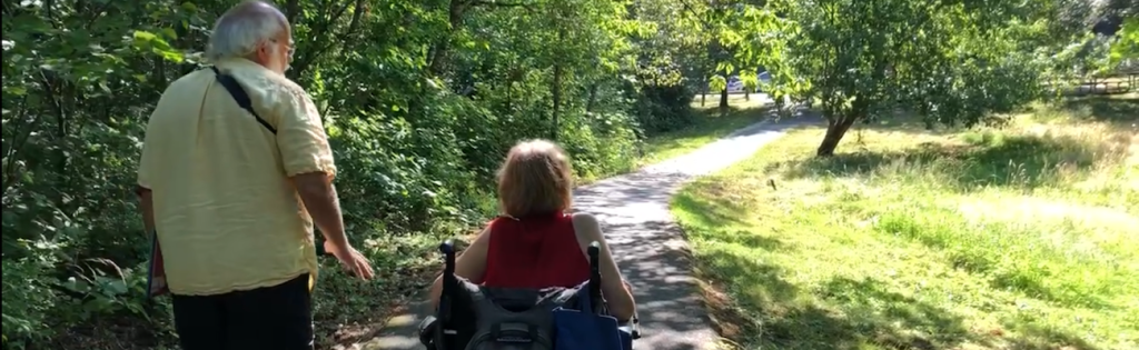
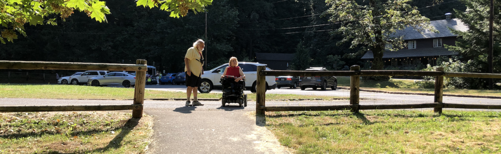
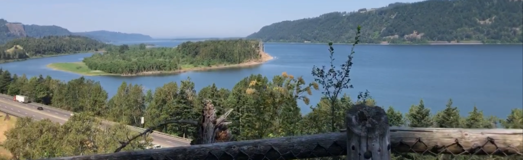
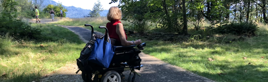
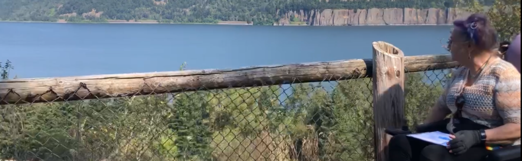
- Hi, I am Syren Nagakyrie, founder and director of Disabled Hikers. We are an entirely disabled-led non-profit organization building disability community and justice in the outdoors. This is accessibility information for Bridal Veil Falls Overlook Trail.It is a half-mile paved loop that leads to some gorgeous views over the Columbia River. Catch a glimpse of Beacon Rock, Archer Mountain, and the Pillars of Hercules. People using mobility devices may be able to enjoy some of the views from the path.However, it has experienced some erosion. Some lookout points are missing pavement. You will find a picnic area that is located off pavement. There is no seating along the trail. The trailhead has one designated accessible parking spot and ADA-accessible restrooms. I use Bridal Veil Falls Trail as a nice stop when I’m driving along the historic highway.It’s a great restroom break, great place to get out and kind of stretch and maybe have some food. There’s usually parking there which is great and it’s a nice spot to kind of take the dog out real quick and just enjoy a little nature break.
AUDIO STORIES: BRIDAL VEIL FALLS
Stop 1: Bridal Veil History
Bridal Veil History | Chuck Rollins, Crown Point Country Historical Society
Welcome to the Bridal Veil State Park. One of the many questions asked is how Bridal Veil got its name. The story goes back to the late 1870s when a woman riding up the Columbia River on a sternwheeler commented on how the falls look like a bride’s veil, and over time when the post office was put in, they accepted that as the official name of Bridal Veil.
It’s actually one of the few post offices that makes a profit in the United States, and it’s also considered one of the smallest post offices in the United States. What happens is weekly they send out hundreds and hundreds of wedding invitations to have the postmark cancellation say Bridal Veil. They’ve been doing that for decades.
One of their best days was 2500, and where they make their money is people buy their stamps there because the cancellation doesn’t cost anything. The first pioneers to settle in Bridal Veil in 1880 was the Moore family who ran a sawmill in Portland, and they needed more timber because the easy trees were already cut. So they came out here to Bridal Veil and realized that with the railroad coming in and the amount of timber that was located on Larch Mountain, there was an opportunity here, and so the Moore family working with L.C. Palmer, who was another sawmill owner in Vancouver, came out and set up the sawmill that operated at Bridal Veil, which was a two-mill system.
Bridal Veil was a finishing mill. Palmer Mill, which was named after Mr. Palmer, was where the logs were taken, sawn, and then flumed from Palmer to Bridal Veil. And there’s a fun story that goes with this that one of the loggers up there wanted to know how long it would take someone to travel down the flume to the mill, so he threw his dog in, and three minutes later the dog was at Bridal Veil.
So he decided to make the trip himself. So he jumped in the flume, three minutes later he made it to Bridal Veil. It took him 25 minutes to get him to the hospital where he spent three months.
So he was the last, first and last, to ride the flume down. The building of the town of Bridal Veil was unique for the Northwest because most loggers were called logger tramps. They would go from camp to camp, and whoever fed you the best paid you the best is where you wanted to stay, but work was seasonal.
Mr. Palmer realized that if he built a school, a church, a hospital, community center, and homes, that the married men could bring their families with them and stay in the camp or stay in the town. He also built boarding houses for the single men where they would have a place to stay also. That way he had enough work that he could keep his crew busy year-round.
One of the interesting facts about the Bridal Veil mill was it was the longest operating sawmill west of the Mississippi and ran until 1970. One of the fascinating things about Bridal Veil was that a lot of tourists came because they wanted to see the falls. When the Columbia River Highway was built, it allowed easier access to these travel destination points and all the waterfalls and the scenic views.
That definitely changed the course of the town of Bridal Veil. Instead of coming in through ships and railroads, now people were driving through and not even stopping at Bridal Veil except to see the falls. For that reason alone, a lot of the smaller mom-and-pop stores went bankrupt because people weren’t stopping.
Before they would come out and stop and then go back, but now they could travel right on through to the downs. Nature Conservancy came in and bought it with the idea of tearing the town down and turning it into a scenic open space. Our society spent nine years fighting this because the Gorge Act was created to also preserve the gorge but to preserve the history of the gorge.
It was the second most reason why people came here was to view these historical sites. Bridal Veil is now the most documented mail town in the state of Oregon because of our efforts. One of my favorite stories about the time of Bridal Veil was, I was doing a historical preservation and a little old lady and her husband, she would nudge him, whisper in his ear, then he would raise his hand and I would say, do you have a question? And he’d say, yeah, did you know my wife’s brother worked at Bridal Veil in 1923? I said, no.
She nudged him, whispered in his ear, he raised his hand and said, but did you know he worked with Clark Gable? And I said, no, I did not know that. I’ve read Clark Gable’s autobiography and they know he worked in a sawmill but they didn’t know which mill. So now because of our presentation, we learned something and that’s the part that really gets me going.
Thank you for listening. I am Chuck Rollins, a local historian and logger. For over 30 years, I’ve been the president of the Crown Point Country Historical Society.
For more local history, I invite you to visit our museum in Corbett.
Stop 2: Sunset at Wachella Falls
Sunset at Wahchella Falls | Waverleigh Duncan, Youth Audio Story Contest Winner
The story you’re about to hear comes from a young storyteller who won the Oregon State Parks Audio Story Contest. We’re excited to share their story with you and invite you to experience Oregon through their eyes.
Hi, I’m Waverleigh and I’m 12 years old. I wrote a descriptive story about Wahchella Falls in the Gorge.
As I walk through the trailhead parking lot, I see the hordes of people coming off the trail. I got here just in time, I think to myself. Heading up the path, I realize everyone is coming off the trail towards me, and nobody is behind me.
I know it’s four o’clock in the afternoon, but I would assume there’d be more people on the path. I see the bridge is around the corner, and it’s the first time there isn’t anyone taking a picture on it. It’s so calming out here, not to mention beautiful.
The sun is just about to set, and the birds are at their loudest. As I stand on the bridge, I take in all the beauty around me. I never realized how peaceful this trail was.
It’s always been too busy to tell. I hear the calming chirps of the birds, and the quiet whisper of the waterfall. I see the steep cliff drop off to the right side of the path, and watch as the pebbles I kick roll all the way down as far as the eye can see.
I watch the sky slowly get darker and darker, and I start to see the silhouettes on the trees on the topmost point of the cliff. I wander down the path, looking around me at the amazing beauty of the forest. It’s mid-October, and the leaves are at their prettiest.
They are pink, orange, and yellow, with a mural of colors painting the pebbles. I see a few people walking towards me. Hi, one of them says.
Do you too find it peaceful when nobody else is on the path? Yeah, I say. Guess so. We get into a conversation.
We must chat for a while, because by the time I continue down the trail, the sun has almost set. I need to move a lot faster if I want to get to the car before dark, considering I can’t even hear the waterfall yet. I start to walk even faster, and eventually I can hear the soothing rush of the waterfall.
As I round the bend, I see the last bridge and the thousands of fallen logs covering the stones surrounding the river. I head down to the water and sit on one of the logs. The sun sets behind the cliff, and I start to doze off.
Stop 3: Coyote's First Foods
Coyote’s First Foods | Greg Archuleta, The Confederated Tribes of Grand Ronde
My name is Greg Archuleta and I’m a member of the Confederated Tribes of Grand Ronde and my tribal family background includes ties to Willamette Tumwater at Oregon City, the Falls area on the Westland side, and the Clackamas Chinook from the Oregon City and Clackamas River region. I’m actually descended from the Tais from both the Clackamas and the Willamette Tumwater that signed the Willamette Valley Treaty on behalf of each of those respective tribes. Oregon City John for the Willamette Tumwater and John, our Chief Wachino from the Clackamas tribe.
And then we also have family ties to Cascade Locks, Tayi Tamákwin, and so the Sandy River is part of our family’s ancestral homeland. I’m also Santiam Kalapuya from the Salem area and Takelma Shasta from Southern Oregon, so those are my tribal family backgrounds. First Foods are our important traditional foods, and for me here along the Columbia River—Wimahl, as we call the big river, including both the Willamette and the Columbia—those rivers are central to our way of life.
But as Tangkia went along the river, the ancient coyote kind of deemed the importance of these first foods. And these include the plant foods, so like the wapato, the camas, there’s many varieties of what our people would call camas-like, other bulbs that are gathered. And then we have the berries, the variety of berries such as the wild blackberries, wild strawberries, wild raspberries, bitter cherry, choked cherry, the elderberries, the currants, etc.
So these are all kind of important first foods that were gathered and some of them were eaten fresh, such as the strawberries and the salmon berries and some would be dried and stored for winter, such as the wild blackberries and the service berries. But these are kind of important foods that we still continue to gather and use and then many of them are used like in first food ceremonies that where we give thanks for those foods in our old stories. It tells how that we are grateful to those first foods for helping us, that they’re sacrificing their lives on their behalf for us to survive and so that we forever give thanks for that purpose.
And that includes those first foods and the salmon, sturgeon, scot quail, the eel, the fishes and the deer and elk, etc. that are all our traditional first foods. But that also relates to things like taking care of the landscape and being respectful of the landscape and the waters and how important water quality is and the soils and the mud and river bottom, how it’s so important to take care of those things also.
Stop 4: Sand Everywhere
Sand Everywhere | Dr. Scott Burns, Portland State University
Scott Burns, Professor Emeritus of Geology at Portland State University. In geology, my specialties are quaternary geology and geomorphology, and then study of the Missoula Flats. This whole area here, I mean, the thing that dominates is the Columbia River.
And the Columbia River has been around for like 16 million years. I mean, it’s been flowing into the ocean, all the way from Newport in Oregon, all the way up to Willapa Bay. And so all of those sediments have been deposited.
And we know that they’re all coming out of the Columbia River because it has a very distinctive set of sediments, which are different than everything else coming out of the Cascade Range and the coastal range. Sand Island, which is down there, it is very unique. And the name is very apropos because it’s all sand.
I still remember sending some students out there to do a series of soil pits on it. The first time we sent them out there, I forgot to tell the students that the riverside of Sand Island is a nude beach. And so they were all really a mess.
They came back and said, we don’t want to do this thing and do the series of soil pits. But the thing is, it’s just all sand. Why? During the winter time, you get the dominant east winds because you get the high pressure areas that build up on the east side of the mountains and you get huge winds coming down the gorge.
The river levels are very low. And so you have high winds, river levels low, and a lot of the sand deposits are exposed because there’s no water on top of them and they dry out. And we get a huge amount of sand being blown down from the east side down to the west side, comes out of the gorge, and then it deposits there.
And this has been going on for 20,000 years. And we know the dates from dating all of the deposits on Sand Island and looking at the soil development, it’s just not very, it’s very, very young soils. And so the sand is continuously building up there.
So the sand is coming out of British Columbia, originated during the glacial periods, Missoula floods brought a lot of that down. And then the winds primarily coming through the gorge have brought the sand down. If you were on the interstate there, going from Portland up to Hood River, Sand Island is going to be on your left-hand side.
And then that whole ridge that is out there is also sand. But if you turn to the right-hand side, those are sand dunes going up the whole side of the valley there. And now they’re all vegetated.
You don’t even notice they’re there, but we as geologists have dug the soil pits. And so you’ve got sand everywhere and it’s all blowing out of the gorge. And so that’s the bottom line, the story that you have got.
It is sand that has been blown through the gorge in the last 20,000 years, deposited in the island. And then that ridge that is right next to the river and then the sand dunes that go up the side.
Stop 5: The Neglected Highway
The Neglected Highway | Bob Hadlow, Oregon Department of Transportation
When they moved the highway, so to speak, over to the water level route, this highway got kind of neglected, but there was a real interest in rehabilitating the highway in the 1980s. It was called out in the Columbia River Gorge National Scenic Area Act of 1986 as a significant resource. Members of the legislature in Oregon in 1987 similarly saw it as a priority to rehabilitate the highway and to create the state trail.
And similarly, the Oregon Transportation Commission saw it as a priority to do that. And since the 1990s, ODOT’s been successful in campaigning for money to carry out this work. And what’s significant is we have about a mile and a half to go to complete the state trail between Trapdale and the Dalles.
And at that point, someone will be able to get on a bicycle in Portland and ride on roads at everything but the interstate highway shoulder from Portland to the Dalles. And that will make the historic Columbia River Highway and the state trail a world-class destination for tourism. It’s not quite there yet because one can’t do that, but we’re very close to having that happen.
The two drivable portions on the end, which are pretty long, had gotten a bit neglected and there was renewed interest in making sure that they were in good shape. And we recreated the white wooden guard fence that was on there from the 1920s, but we recreated it in such a way that it met current design standards. This is back in the 1980s for crash-worthiness at that time.
And then we got the go-ahead and we found funding to install that. Before that, we had all sorts of guardrail, white guardrail, plain metal guardrail, different shapes, what we call C-rail and W-rail. And there was just a menagerie of things.
And so there was that and then structures, the spindles on the deck on some of these bridges like Shepherdsdale and Latterell, they were missing. It was like missing teeth. They just deteriorated and there was nothing left.
So there was an initiative there to recast all those. And then more recently, we have gutters along the side of the road. And you say, gutters, what are those? Well, they’re concrete gutters to take the water off the sides of the road and then carry it down into the vegetation.
Well, they’ve been covered up or broken and they weren’t working and we really needed to get them back. And so there was a project to discover those and then repair them and recast sections that were missing. And in some areas, there had been so much extra asphalt laying on the road that the drop-off between the road and the gutter was significant.
And so there was an initiative to remove all that extra asphalt and then put a good lift of asphalt on the original asphalt from the teens. So we did all that on the drivable sections. So on the drivable sections, they’re good places for people who don’t mind riding bicycles with automobiles because it’s not the interstate.
But then there are sections, then there’s these gaps that we’ve created a state trail, the Historic Columbia River State Trail by connecting little bits and pieces of the highway or in the section between Hood River and Moser, there’s a long section there that had been closed, including the Moser Twin Tunnels. And that was one of the first that ODOT and its partners rehabilitated and that included cleaning out the tunnels and creating some rock catch structures there to make them safe. It wouldn’t have been safe for people to ride.
And that all of a sudden became very popular. It’s a long section, four and a half miles where you don’t have to worry about cars and you can ride your bike and walk and stroll with your kids and do some rollerblading and what have you. And it’s a very safe environment for that.
So, and the people who are okay with riding their bikes along the shoulders on the drivable portions, of course, they’re gonna ride those too. So for those folks, once this last trail segment is completed, they’ll have a whole route to ride from Troutdale to the Dallas and back.
Stop 6: The Grand Canyon and the Gorge
The Grand Canyon and the Gorge | Toby Patrick, Confederated Tribes of the Umatilla Indian Reservation
My name is Toby Patrick. I’m a board member at large, board of trustees for the Confederated Tribes of the Umatilla Indian Reservation. See, because the Spilii, see that one happening down there in the John Day area, Glass Buttes, so the creator says you got to try to fix it.
So the Spilii went down south, way down south, and he picked up this rock, picked up this other one, and he put them together, and he started rubbing them, and he seen them sprinkling down. Whoa. So he picked up what he could carry, and he had two of them, and he brought them up there, and he put them over the Glass Butte.
He started rubbing those rocks like this, and they were grinding down, and here he was spreading that sand. Those were sandstone. He’d rub them together, and that’s what was covering that Glass Butte.
He did that from there all the way from down that way, and started working his way up here. He’d make his way all the way up here, and he’d come across the river, and he was trying to help him out across the river. He thought he figured out this way to grab the sandstone and bring it up here and do that.
He’d spread that sand out and get down, get down to it, and go back down, grab two more, and come back up and start over where he left off. Do that all over again, finish up there, and then he’d go back, grab it. He did that all the way up, trying to help the land, and at the same time when he did that, that’s when he created the Grand Canyon.
That’s where that sandstone was coming from. He just created it, and when you look at the Grand Canyon and how it came apart or whatever, how it looks, that’s because the spilling that was going and taking the sandstone and bringing it up here. You test the sand out, it comes from the south.
It’s the same sand. That’s the story that was shared with me, and I was like, I don’t believe you, Grandpa. Then I started doing cultural resources, and we had to do sand testing.
We had to do the, it was a GPR, ground penetrating radar, so you had to do the soil testing. You know what? I’m going to Glass Buttes too, and I’m going to be picking up some obsidian, so I think I’ll, can we do a test off of that and grab some? We’ll do some soil testing off of that too, so I did. I went to Glass Buttes, and I scored some little, you know, little can, little bundle of sand, brought it back, brought it back to our people, soil tested, soil sample.
We soil sampled from Hanford. We soil sampled from John Day Burns area, little sand area that we would come across down there. All three samples matched.
They come from the, to me, they come from spilling, sprinkling that sandstone out. That’s what he did. That’s what Grandpa told me, so I believe that.
I was just like, oh man. Kind of like how the Grand Canyon was created, but that’s what created our desert, our sand dunes and everything from down that way up this way, because when you get up there into the mountains and you see that sand, you do a test of that sand up there, like at Cold Springs. It’s almost the same stuff that the spilling I brought from down the Grand Canyon.
Walk This Land with Respect
Walk This Land with Respect | Greg Archuleta, The Confederated Tribes of Grand Ronde
My name is Greg Archuleta and I’m a member of the Confederated Tribes of Grand Ronde and my tribal family background includes ties to Willamette Tumwater at Oregon City, the Falls area on the Westland side, and the Clackamas Chinook from the Oregon City and Clackamas River region. I’m actually descended from the Tais from both the Clackamas and the Willamette Tumwater that signed the Willamette Valley Treaty on behalf of each of those respective tribes. Oregon City John for the Willamette Tumwater and John, our Chief Wachino from the Clackamas Tribe.
And then we also have family ties to Cascade Locks, Tayi Tamákwin, and so the Sandy River is kind of in our family’s ancestral homeland area. And then I’m also Santiam Kalapuya from the Salem area and Takelma Shasta from Southern Oregon. So those are my tribal family backgrounds.
And first foods are our important traditional foods that we have. And for me, on the Columbia River here, Wimahl, we call the river, the big river for both the Willamette and Columbia, the big river, Wimahl. But as Tonk’ia went along the river, the ancient coyote kind of deemed the importance of these first foods.
We are grateful to those first foods for helping us, that they’re sacrificing their lives on their behalf for us to survive. And so that we forever give thanks for that purpose. And that includes those first foods and the salmon, sturgeon, scallop, the eel, the fishes and the deer and elk, etc.
But that also relates to things like taking care of the landscape and being respectful of the landscape and the waters and how important water quality is in the soils and the mud and river bottom. How it’s so important to take care of those things also. As you’re out there and about on the landscape, that responsibility for caring for the landscape, being respectful to it.
And not only for the indigenous people, tribal people, but for everybody. There’s a lot of responsibility, I think, on individuals to be very mindful of how they walk the land, and how they care for the land, and how they treat the land.