
The Dalles Riverfront
- Syren Nagakyrie, Disabled Hikers
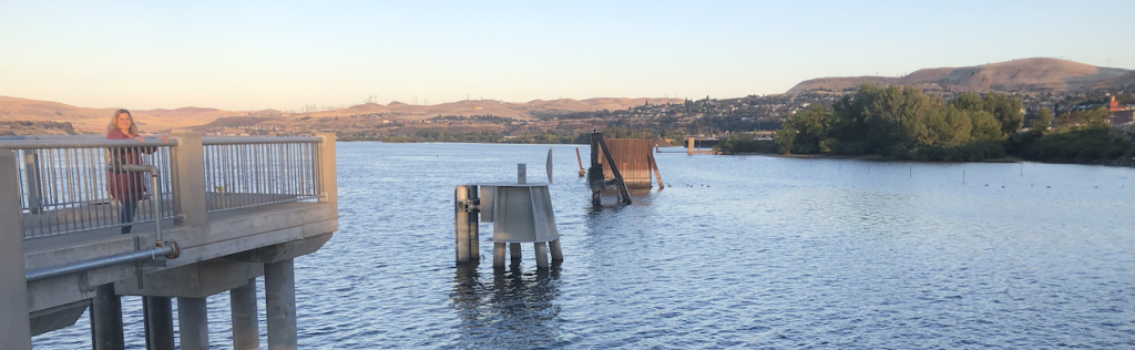
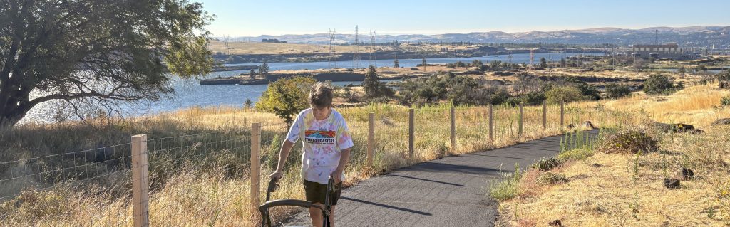
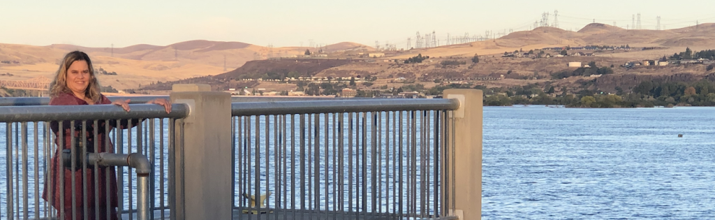
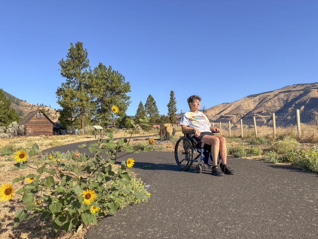
- I am Syren Nagakyrie, founder and director of Disabled Hikers, and we are sharing information about the Riverfront Trail. The Riverfront Trail runs about eight miles along the Columbia River near the Dalles, Oregon. The main path connects the Riverfront Park to the east and the Discovery Center to the west, with beautiful views of the river and Klickitat Hills all along the way.A less used path extends further to the east past the park. The paved path is eight feet wide and mostly flat except for a hill that starts 0.3 miles east of the Discovery Center. This hill gains 82 feet over 0.3 miles. Public bathrooms can be found at Riverfront Park, Clint’s Cove, and at the Lewis and Clark Festival Park, two blocks from the downtown area on Union Street. There are also ADA accessible public restrooms at the Discovery Center during museum hours. The Festival Park has two designated accessible spots and 48 regular spots.The park includes several picnic tables and curb cuts on all sidewalks from downtown. The dock near the park is flat and paved with a three foot three inch entrance. The Discovery Center has plenty of accessible parking spaces and curb cuts in their lot.
AUDIO STORIES: THE DALLES RIVERFRONT TRAIL
Stop 1: Pack It In, Take It Out
Pack It In, Take It Out: Wilbur Slockish, Jr, Yakama Nation
I am Wilbur Slockish Jr. I’m a Klikitat. Walking on these trails, be careful of the rattlesnake. He’s still here and be mindful of the poison oak and poison ivy and other animals that shouldn’t be disturbed.
I hope that people will be safe when they walk on these trails and remember to take care of it. Don’t abuse it, you know, pull plants or all of that. It takes a while for everything to recover, so be mindful of the water.
The water is giver of life, so be mindful when you’re on these trails. Make sure you pack it in, take it out, don’t leave litter, as once this place was gorgeous, but some disregard the regulations and dump things and all of that. So be careful when you walk these trails, whether you’re on Oregon side or Washington side.
Those were our highways that we moved to go to village sites and other food gathering areas. I hope you’re safe on this trail. I hope you be mindful of that and have fun, but don’t litter, please.
Stop 2: The River Was First
The River Was First | Phil Brady, Teacher
We’re at a point on the trail now where we can look down the Columbia River and see where it enters the Columbia River Gorge for real. So the question arises, how did the gorge form? How did the river get through there? We have to start with what comes first. The river was there first, maybe forever.
If we go back to what before Oregon was land, it was rising out of the Pacific, that’s about 60 million years ago, after the time of the dinosaurs, so we don’t find dinosaur bones here because Oregon was still mostly underwater. There were no cascades. This part of Oregon was a broad river valley, think of something like the Willamette Valley or even the Mississippi Valley, that started up near Spokane and stretched wider and wider all the way to the Pacific coast, with the middle of it somewhere around Lincoln City.
The Columbia River flowed from the north in the Spokane area right through the Dalles and on to the central Oregon coast. The Snake River also flowed through this same valley south of the Columbia River from Idaho and it joined the Columbia somewhere along the way. The gorge began when the Cascade Mountains started to rise up.
They started about 40 million years ago with small hills like the West Hills of Portland. The oldest eruption of that is some rocks down near Kalama, Washington. You can still see those rocks as you drive by on I-5.
These were small mountains and wasn’t any problem for the Columbia River to go to one side or the other, but the rise of the West Hills near Portland did push the river north up to where we see it turn at Longview and head down. But still the question is, how did the river get over the Cascades? And the answer is, the river was there first and so it would carve its channel and keep deepening its channel as the Cascades grew on one side or the other. We see a good example of this right here.
On the Oregon side is Seven Mile Hill and on the Washington side is the ridge called the Columbia Hills. Actually, Seven Mile Hill and Columbia Hills are one and the same ridge. It’s a continuous flow.
This land, it’s lava flows. If you look closely, you can see where they’ve folded, where they are arched upward. As that ridge continued to grow up and up and up, the river kept cutting down and down and down.
So the river kept finding its way through the middle of this broad valley as the Cascades grew up and up. Now about five million years ago, the Cascades started to grow up not just from volcanoes, but as an entire ridge. There was a folding under the earth that gave them an extra 5,000 feet.
And the Columbia River still managed to carve its way down in its same gorge as the Cascades grew on either side of it. The high Cascade Mountains, places like Mount Hood, Mount St. Helens, Mount Adams, they’re very recent, just one or two million years ago. To finish off this story, about 12,000 years ago at the end of the Ice Age, the Missoula floods came down through this point, causing a 400-foot wall of water moving at 50 miles an hour.
If you look closely on the Washington side from this point, you can see some horizontal bands about 400 feet above the river level. That was how high the water was, and the Missoula floods came rushing through here. The Missoula floods were a finishing touch to carve out the gorge, but the gorge was there before them.
This is Phil Brady. I’ve enjoyed living here in the gorge. I think it’s a privilege that, wow, we get to live here, and I hope you enjoy it too.
Stop 3: Isn't It Great To Be Alive?
Isn’t It Great to Be Alive? | Dan Durrow, Wasco County Commissioner
Isn’t it great to be alive? These words caught me completely by surprise while walking along the Riverfront Trail on a beautiful spring morning a few years ago. They came from a man who was sitting alone on a large rock on a cliff high above the river, enjoying the splendor that surrounded him. His words struck me like an epiphany.
In that moment I realized that all the hard work of more than three decades to create the Riverfront Trail was worth the effort. It was the greatest thank you that anyone could have given, unscripted and genuine. I’m Dan Durow, formerly the Director of the Wasco County Planning Department and then Director of the Community Development Department for the City of the Dalles.
I’m retired now but I remain part of a dedicated team of people who created this community treasure and continue still to maintain it in good condition. It all started more than 40 years ago in the early 80s when a group of runners started doing fun runs on Fridays after work. We were mostly of the baby boomer generation and running was an important focus for us then.
Various routes were planned by members of the group to cover new areas around town. One day Ryan Rupert led the group along the river’s edge. It was a somewhat treacherous route with basalt cliffs, rock outcroppings, and overgrown vegetation.
I remember him asking as we ran along together wouldn’t it be nice if we had a trail here? That question stuck with me because access to the Columbia River was the reason people had been living here for more than 12,000 years. But that access was lost with the building of the railroad and then the freeway and with the divided ownership of land along the river. You could see the river but you couldn’t get to it.
Then one day in 1987 when I was still with the county a letter landed on my desk from the National Park Service in Seattle. It was a solicitation to apply for a recreational planning grant. With the help from the National Park Service personnel the idea of planning for a trail turned into a much larger riverfront development planning process with recreational access being the focus.
A planning committee of over 30 people was formed which represented all the various interests along the river. After a year of work the plan was completed and trail development began. From the original committee a non-profit corporation the Dalles Riverfront Trail Inc was formed.
This group of dedicated people has been meeting monthly for nearly 40 years working hard to accomplish the task of creating the trail and providing access to the river once again. One example of our work was the challenge of raising over a million dollars to connect the trail by building a tunnel under the railroad tracks. So the question wouldn’t it be nice if we had a trail here was answered on that beautiful spring morning.
Isn’t it great to be alive? If you’d like more information about the trail please contact the Northern Washoe County Parks and Rec District. Thank you for listening.
Stop 4: The Balsamroot Experiment
The Balsamroot Experiment | Barbara Robinson, Ecologist
I’m Barbara Robinson. I’ve been involved in conservation, especially wildflower conservation and oak conservation in the Columbia Gorge since 1969. If you walk the Riverfront Trail today, starting at the Discovery Center, you’ll see a lot of sunflowers or balsam roots in bloom, they’ve been in bloom lately.
But if you explore this area, you’ll see lots of places where there are not balsam roots. You’ll see fence line contrasts where there are balsam roots on one side of the fence and not the other. And that’s because balsam roots get grazed off and plowed off.
And so, there was an area where balsam roots had been wiped out by grazing. And in 1987, I wanted to see if it was possible to restore the balsam roots. I did an experiment where I planted test plots.
And I found out that all you get the first year is one leaf, one inch long. It took seven years to get any flowers and an average of 10 before they bloomed. I didn’t start seeing babies till 14 years afterwards.
So, I found out, yes, you could plant balsam roots and get them, but it took a long time. I found that when you see a big field of balsam roots, it’s probably an old growth meadow. It probably took hundreds of years for that to develop because balsam root seed don’t spread by the wind.
They just drop near the main plant and you get big clumps. So, but you could do it. So, in 1987, I took on the Columbia Gorge Discovery Center grounds and the year it opened in 97 and planted balsam root seed.
And again, it took about seven years to see any flowers at all. By 10 years, I was seeing a fair number, but now it’s been over 25 years. And so, you see quite a few there.
So, it does work eventually. I want to say though that in the Willamette Valley, there were balsam roots too. It was a species that grows there.
I’ve never seen a single balsam root growing in the Willamette Valley. We have here sort of a remnant of what the settlers would have seen in the Willamette Valley because our land is rougher. We get places like Mamelouse and some other places where the flowers have been preserved.
And this isn’t just balsam roots. This is also the lupins, the larkspurs, the shooting stars, the baby stars, the prairie stars, all the little flowers too that grow. And what I found at the Discovery Center, and this is through Catherine Creek to the lower part of Catherine Creek, you get a diversity of flowers.
What I’ve seen is that at the Discovery Center, I succeeded in getting balsam roots there and lupin and some other things too, but the bigger flowers especially. But I can’t get those little flowers. I can’t get the 30 or 40 species that you would see when land has been left as it was when the Indians knew it.
You can’t really do a full restoration. So it’s so important to preserve land that we have here that still has that feature, that has that diversity that would have been here 200 years ago. Willamette Valley has practically nothing left of that.
We have a little bit. Willamette Valley can only talk about restoration. We can talk about preservation.
So it’s so important when you walk out and you see that diversity of flowers to respect it and be careful of it and work to preserve those pieces too.
Stop 5: When Lava Cools Down
When Lava Cools Down | Phil Brady, Teacher
In this part of the trail, as it winds through the rock formations west of Taylor Lake, we get a good look at what happens when basalt cools down. The basalt here started as lava flow coming all the way from eastern Oregon around Milton Freewater, and it flowed fast and gooey and got all the way to the Cascades and sometimes reached the Pacific Ocean. But when it stayed in one place, it had to cool down.
If it cools down slowly, it forms these columns that we see, called columnar basalt. If we look straight down from the top, each column is usually a hexagon or a pentagon. That’s because each piece joins with three other pieces, and the spot where the three angles form is 360 degrees divided by three, or 120 degrees.
So columnar basalt forms when the lava cools very slowly. When it cools more quickly, it forms irregular cracks, and we call this hackley basalt, like hackles on a chicken. These are irregular shapes because it hasn’t had time to slowly form hexagonal rocks like the columnar basalts.
Sometimes the lava has to cool extremely fast because it is flowing into a body of water. That’s happened here as well, east and west of the Dalles. On the east side, Highway 197, where it leaves the bridge and starts going up the hill, we can see a road cut with orange rocks and black streaks in between it.
That’s where lava flowed into the Columbia River, just like we see lava right now in Hawaii flowing into the ocean. It makes worm-like structures grounded by other rocks that’s happening because the water and the lava are reacting with each other. This rock formation is called pillow basalt because sometimes one of those worms lines right up on top of the other, kind of stacked up like pillows with blankets of orange rock all around them.
The lava flows that we see all around us in the Dalles weren’t the end of the story. After they stopped flowing about 12 million years, some other lava flows happened. Looking south from the trail to the horizon south of the Dalles, we can see what are called the Eagle Caves, and above that is another lava flow that’s independent of the Columbia River salts, and below that was some soil that had built up.
The Eagle Caves are that loose soil that eroded away underneath that lava flow. Another event that happened later is down in the center of the gorge at Beacon Rock. That was another volcano that erupted up through the lava flows, and then the sides of that volcano eroded away because they were soft, leaving the hard core of columnar basalt behind.
Sometimes in a few places the lava did get all the way to the Pacific Ocean. There it formed the headlands like Tillamook Head, and in a few places when it started getting to the soft sand, the lava burrowed deep into the sand because it was heavier and more dense, and extended out into the ocean underwater, and then erupted again out in the ocean as headlands further out. This is Phil Brady.
I’ve enjoyed living here in the gorge. I think it’s a privilege that, wow, we get to live here, and I hope you enjoy it too.
Stop 6: Raptor Calls
Raptor Calls | Flora Martin Gibson, Journalist
Raptors of the Gorge. Northern Harrier. Almost got my hat clipped off by one of these swooping over Taylor Lake.
You can tell them by the big white patch on their rump and the very striped tail. Males are pale grey and females are brown. That’s called sexual dimorphism.
They’re not dangerous except to tiny mice and voles and rats who live in hope the thicket of plants on the leech will protect them. Bald Eagle. You know this one.
A few bald eagles nest here so if you see a big black bird with a white head and tail in spring it’s probably looking for a dead fish or a yummy duck or a dead deer or other nice delicious tidbit for its chicks. In December you’ll see oak trees full of eagles like a hundred white candles in the distance. As Alaskan rivers freeze they come here to eat shad, a non-native fish introduced from the eastern U.S. That’s so common it’s practically replacing salmon here.
The resident eagles will sit side by side near their nest trees and side-eye the visitors until they go away. Osprey. Ospreys come in the summer to nest on platforms specially made for them like the one at Riverfront Park or pilings or old buoys sometimes on telephone poles where they oughtn’t nest.
These huge black and white raptors only eat fish caught in spectacular dives and in spring you can see them dancing over Taylor Lake, two flying in perfect synchrony, passing fish to each other and screaming. This is their idea of romantic. Great horned owl.
That lower pitched voice is the male. The higher pitched sound you hear is the female. By January they’re already nesting.
They’ll start by refurbishing another raptor’s nest, not building their own, or they’ll find a hole in a cliff. By spring the chicks will be flapping around on their own, just in time to gobble up all the young and ignorant ground squirrels and rabbits who are also having a growth spurt just then. If you find a fallen feather patterned in half a dozen shades of brown and it’s covered with a soft fuzz, that’s an owl feather.
It’s a federal crime to keep raptor feathers but you can look. Western screech owl. Can also scare you with a sound like this.
Not that I’m speaking from experience or anything. Nests in holes by streams, rivers, and lakes. Eats mice, crayfish, snakes, bugs.
Cooper’s hawk and sharp-shinned hawk look identical. Here’s a cooper’s and here’s a sharp-shinned. They nest here too and eat small birds and mammals and good luck telling them apart because they both have black heads and grey backs and orange barred undersides and yellow feet with black talons as long as your little finger and bright red eyes although I don’t recommend you get close enough to see that if you’re a sparrow.
American kestrel. A bright orange hawk so small she eats grasshoppers as well as mice. The male has sky blue wings.
Often attacks bigger hawks from the air like a tiny bomber plane, screaming and diving over and over again, defending their tree. Written by Martin Gibson, a bird and natural resources student and journalist from The Dalles.
Stop 7: From Onions to Bytes
From Onions to Bytes | Carolyn Wood, Historian
Where you now walk, ride, or bike has seen dramatic changes over the past 70 years. I am Carolyn Wood, a local historian and longtime resident of the Dalles. Before the port leveled this area into a developable lot, it was a rocky, hilly landscape with a long beach.
When I was a girl in the 1940s, this land had been an onion farm and a local garbage dump. The onion farm was operated by the Klindt family, the same family associated with Klindt’s Bookstore and Klindt’s Cove. Klindt Cove Park now occupies the site of the original family home.
Nearby, with the completion of the Dalles Dam in 1957, cheap hydropower made aluminum smelting profitable, and the Harvey Aluminum Plant was established and employed nearly 500 blue-collar workers, providing steady incomes and security for many local families. However, almost immediately, the company faced lawsuits from the local orchardist regarding the severe air pollution from the smelting operations. After 60 years of operation, the aluminum plant has shuttered its operations.
The construction of Interstate 84 in the 50s cut the Dalles off from the river. In the 1980s, the port passed a bond measure to develop the riverfront. As development unfolded, local citizens identified the need to create a pedestrian trail, the one that you are standing on now.
In the summer of 1996, a major fire known locally as the Fir Mill Fire destroyed the wood chip plant west of the Chenoweth Creek. The fire burned roughly 70 acres between the freeway and the chip plant. With embers crossing the Columbia River, it was never rebuilt, marking the end of an era.
As aluminum smelting declined, the port continued to evolve. During the 1990s, new commercial businesses moved in and zoning changes approved by the City Council allowed residential units within the commercial buildings and opened the door to multifamily housing. Rumors began circulating that something big was coming to the port.
By 2010, Google had constructed its first data center and then a second one. Today, buildings four and five are close to completion on the former aluminum plant site, and the server buildings continue to grow in scale. I’ve been around long enough to remember when this place looked very different.
From onion fields to aluminum processing, from gravel roads to transmission lines, this riverfront tells a story of constant becoming. As you move through this place, I hope you’ll imagine not only what it is today, but what it has been, and remember that the story of the port is still being written. You are now part of the next chapter.
Stop 8: Just Like Gramps Said
Just Like Gramps Said | Toby Patrick, Confederated Tribes of the Umatilla Indian Reservation
My name is Toby Patrick. I’m a board member at large, board of trustees for the Confederated Tribes of the Umatilla Indian Reservation. I’ve been enrolled there with the Confederated Tribes since 99, and from 1969 up to 1999, I was an enrolled Yakama under my mom.
You’ve got to wake up and pray. Every morning there’s a song that you have. There’s a—watch that song, our religion songs that we sing, and you wake up and you watch that sun come up in the morning.
Maybe you get up and you see it’s just starting to get twinkly. Why? I don’t know, because I can’t sleep? What else am I going to do? Why do Gramps and I always get up so damn early? How come you guys are up singing? I’m trying to sleep. Sometimes.
You guys going to sing? Oh, we already did, like, two hours ago, you know. Wow, man, you’re lazy. Lazy? Gee, it’s seven o’clock.
Saturday, I want to watch cartoons, but I’m being called lazy because it’s Saturday, and it’s—yeah, exactly. What? But I think about what Gramps and I look at me and tease me in that regard, and where I am here today, being able to wake up, and Gramps ain’t here, my dad ain’t here, but I am. And when I think about it, Gramps and I gave me that.
My mom and my dad gave me that, and they always talked about love and respect. You walk with that and see how far that takes you. See what that does for you.
It doesn’t make you better, and it doesn’t make you worse. It’s going to make you a fine example, though. Don’t let that get to your head.
So I sit there, and you know what I mean? It’s just like, get up and make the point, but beat myself up to not stand. I stand for the right reasons. Crazy, but that’s the teaching, you know what I mean? Where did you learn this stuff? I had a person ask me that at the state capitol.
Man, where’d you learn this stuff? That’s kind of cool, the way that you put it all together. It’s just like Gramps said. I got to do my readings, I got to watch my TV, my YouTube, or whatever, and understand what society’s doing.
Understand how society thinks the best that I can, and remember who I am, and never forget where I come from, and put it all together and bring it forward. How do you get that knowledge, Gramps? Right? Just through living. Just through being able to live, and tell me about where I come from and who I am.
All of those things that I had growing up, how beautiful it was. My mom and my aunties, her sisters, her brothers, my dad, his brothers and his sisters, my other aunties and uncles. I mean, it’s just, you grow up and you see that you have a big family.
You have all of these beautiful people in here. There’s no reason why you shouldn’t have a big heart. There’s no reason why you should have a big ability.
There’s no reason why you should have all of these other things that match that. The size of your family should match the size of love you have, the size of heart, the respect that you walk with. Those things should match.
So you walk and you look at that, and it’s not just mom and dad in Indian country, because your aunties and uncles want you to succeed. They want you to do good. And if you’re messing up and you’re doing bad, they’re going to grab you, shake you around and slap you, whip you, whatever, and tell you, sit you down, and then tell you, this is what I want you to do, because your dad said this.
He worked really hard, because they care. If they didn’t say anything, they wouldn’t care. They just let you keep being you, doing whatever you want to do, and being embarrassed.
Oh, there’s Sonny embarrassing me again. So, you know, those type of teachings and those types of things don’t get put out enough. You’ve got to be thinking that way, because you allow society to take over, and it makes you small, makes your heart small.
Now you don’t care about anything other than what you see in front of you, and what you need to get done. Now you’re not worried about anything else, nobody else, and that’s a hard way to live. That’s how a lot of society lives, but you know, you’ve got to understand that, son.
All right, pops, all right.
Stop 9: Beavers Along the Columbia
Beavers Along the Columbia | Margaret Neuman, Mid-Columbia Fisheries Enhancement Group
My name is Margaret, and I’ve worked in watershed restoration my entire career. Restoring streams is complex, difficult, and expensive, but beavers do this work naturally. They build wetlands, improve habitat, and support healthy stream systems.
These amazing animals live throughout the Columbia River Basin, in rivers, streams, lakes, and ponds. They live throughout most of the United States and Canada. Beavers spend most of their lives in water, but they are mammals.
Baby beavers are called kits. Beavers are prey animals. Something that you might not know that surprised me is beavers build their homes with underwater entrances to protect their babies from predators.
Some beavers live in bank burrows, and many live in homes constructed of piles of sticks called a beaver lodge.
Beavers are famous for building dams. They build dams to pool up water to keep themselves safe from predators.
It’s rare to see a beaver since they are most active at night, but you can look for signs like chewed sticks, sharpened tree stumps, dams, and lodges. Beavers have large teeth for chewing wood, and they eat cambium, the living layer of cells beneath the tree bark. Beavers especially love willows, cottonwoods, and aspen.
When beaver dams back up water, it raises the groundwater and helps plants grow. People are sometimes troubled because beavers cut down trees. But by raising groundwater, beaver dams also help create the wet conditions that support new plant growth.
Beavers are nature’s ecosystem engineers. Those dams back up and store water on the landscape, creating habitat. Beavers are especially important in dry climates and throughout the arid west, where their work on small streams can make a huge difference for habitat and water storage.
There were once millions of beavers across the Pacific Northwest and Canada. Over time, they were trapped and removed, but beavers are still found throughout many watersheds. When we give them space, they can return and improve habitat that benefits fish, birds, wildlife, plants, and people.
Throughout the Northwest, many groups are working to restore habitat for salmon and steelhead. Healthy watersheds and streams benefit salmon, wildlife, and communities alike, including tribal nations who have lived here since time immemorial. Sometimes beavers come in conflict with people by flooding roads or property or blocking culverts.
In some places, people can modify infrastructure or adjust beaver dams to reduce conflicts and allow humans and beavers to coexist. When coexistence isn’t possible, beavers can be relocated to habitat further away from homes and roads. Some Native American tribes are leaders in the science and practice of beaver relocation, including the Yakama Nation.
Nearby in Washington, the Wishpush Working Group is helping relocate beavers from conflict areas to upstream habitats where they can restore watershed functions naturally.
Another fun fact is that the name Canada comes from the scientific name for beavers, canadensis. I hope you have the opportunity to look for signs of beavers, learn more about them, and enjoy nature and streams as much as I do.
Stop 10: Tribal Fishing Rights and Four Powerful Words
Tribal Fishing and Four Powerful Words | Buck Jones, Columbia River Intertribal Fish Commission
Yeah, my name is Buck Jones. I’m an enrolled Cuyoosh tribal member, one of the bands of the Confederated Tribes of the Umatilla Indian Reservation, and for the past 21 years I’ve been employed with the Columbia River Intertribal Fish Commission. In the 1850s, the government came out with treaties for the tribes.
They had met with the treaty to move us to reservations, to move our tribal members to reservations, and so what our ancestors and our treaty signers had the fortitude of negotiating these treaties is that, you know, we had to cede millions and millions of acres of our land, you know, and reluctantly, yeah, they said, we’ll cede those, you know, those millions of acres for, you know, to move on to these reservations, but we’re not going to sign these treaties without, you know, our hunting and fishing and gathering rights. We want to retain those fishing and hunting and gathering rights, you know, at our usual places that we fished. It actually says usual and accustomed places, so that was a really key situation that, you know, because treaties are the supreme law of the land or whatever, and in those treaties we retained those rights, you know, and it was signed into the treaties, and that’s really upheld our rights to hunt and gather and fish, you know, where supreme court case decisions were made because of these treaties and upheld, you know, different, there’s been different attempts to deny our fishing rights, and it hasn’t been perfect.
There’s been, you know, some erosion of some of those rights, but the signing of that treaty, you know, and having those those terms in there has really upheld our right for, for, you know, specifically for fishing, you know, that, you know, our member tribes have had these cases, you know, go through the local, then they went all the way to the supreme court, and they’ve been upheld, so that’s really, really, really key, you know, and I always think of our, you know, that the way tribes, tribal people think, they think of the, you know, the seven generations ahead of them, and they think of, you know, the seven generations behind them, so those ones was looking out for us in these days, you know, when they thought through that or whatever, because, you know, reluctantly they didn’t want to, you know, give up our land, but, you know, there was, it was beyond that, so those signing those treaties with those those terms in there has been, has really been a key, and so that really allows us to have those treaty fishing rights.
Stop 11: Rocks Aren't Boring
Rocks Aren’t Boring | Phil Brady, Teacher
Back when I was a kid, I thought all the rocks here in the Columbia Gorge were pretty boring. But as I’ve learned over the years, they have an amazing story. The rocks that we see all around us here are basalt.
The word basalt means hard stone. It came from the Greek language. And it is hard, but when it flows out as lava, it’s very soft and very gooey.
It’s a kind of lava that can flow a great distance, hundreds of miles before it solidifies. And there’s other kinds of lava that don’t flow like this. They pile up instead of flowing very far.
And as a result, they make the tall stratovolcanoes like Mount St. Helens and Mount Hood. The flow that we are talking about is the Columbia River basalts. We’re right in the middle of it here on the waterfront trail.
It’s one of eight huge lava flows like this in the world. They’re best known as the Deccan Traps in India and the Siberian Traps in Russia. They’re about 10 times larger than the Columbia River basalts.
If you look at pictures, or if we were fortunate enough to travel to India or Siberia, it would look amazingly similar to our lava flows here in the Columbia Gorge. Folded lava formations with rocks that are the same color and arranged in the same formations as what we have here. And those larger basalts had the bad habit of causing mass extinctions when they’d flow out.
And I think it’s pretty nice of us, very considerate, that our Oregon-Columbia River Gorge didn’t kill a lot of the environment. The flow of lava did not come from a volcano. It came from far eastern Oregon, around Milton-Freewater, and a bit south.
And it started about 16 million years ago. Think of it coming out of a crack in the earth. And if you want to see a crack, you can look down Smith Rocks in central Oregon.
It would be one of these cracks called a vent. When it flows out, it flows out in a large layer, 100 miles wide, as long as it can travel 300 feet, and be from anywhere from 10 to 100 feet deep. One layer flows on top of the other and ends up looking like a layer cake.
And it just piles up, up, and up, higher and higher. Altogether, these have covered the area roughly from the Oregon-Idaho border to all the way to the east side of the Cascades. And from the southern border of Wasco County, I’m talking down there by Shanico, between Shanico and Antelope, all halfway north through Washington, up by Ellensburg.
As they piled up, they got deeper and deeper. The average depth is around 4,000 feet. But some places are even deeper, 15,000 feet deep near the Tri-Cities.
So the question then is, well, if it’s 4,000 feet deep, why aren’t we 4,000 feet elevation? And the answer is because basalt is heavy. It’s so heavy that it piled up and made the earth’s crust depress. Just imagine you’ve got a mattress and you mix a bucket of cement and pour the cement on the mattress.
Originally, the cement will be higher. But the weight of that cement will push down and become lower eventually. Here’s one more thing about basalt.
It can absorb carbon dioxide. If we wanted to, we could drill deep wells and inject carbon dioxide into the basalt right below us, and it would turn into calcium carbonate. Or a person can grind up the basalt, spread it on your field, and it’ll absorb the carbon dioxide right out there on the farm’s field.
So as you’re moving along, be thinking you’re walking on 4,000, 5,000 feet of lava flows that flowed out 16 million years ago. This is Phil Brady. I’ve enjoyed living here in the Gorge.
I think it’s a privilege that, wow, we get to live here. And I hope you enjoy it too.
Stop 12: Fishing the Columbia Before the Dams
Fishing the Columbia Before the Dams | George Aguilar, Sr. Warm Springs
I was given the name of George Washington Aguilera, after introducing myself. I was born on Washington’s birthday, and that Sunday, only two days ago, I became 96 years old. One thing I want to say about the Columbia River.
Well, for one thing, the river don’t run wild anymore, that’s for sure. My activity along the Columbia River was from about 1935 as a child. I became quite familiar with Celilo at that time.
As a child, listening to all the trains come by, they had two railroads coming through there. And here comes the train, puffing away, making a great big sound. This was right below Chief Tommy Thompson’s fishing scaffolds.
And every time a fish, their dip net would touch the rock, they would spook the fish right back into my net. And oh boy, I was really catching a big, I was catching 40 pounders with that set net. But anyhow, we had 13 places from all stages of the river.
Right about this time, right about this time, March, we were getting ready to set up scaffolds at our place on Escucha’s fishing place. And there’s another place called, right above that, besides Escucha’s fishing place, is called Coyote’s Hole. From April, the water started rising.
And we moved from fishing place to Escucha’s fishing place. And Escucha’s fishing place is actually a fish wheel that Seufert modified for a fish wheel. He ruined the fishing area because he put a baffle above that little island.
Now there’s a photograph by Watkins that was photographed in 1855 of Escucha’s fishing place. Now above this channel is a baffle. So the water came down very swift in that area.
It’s all boiling water. And this place, this place, before Grandmother told me, before the fishing wheel took place, this is when the silverside came up. And the silverside went extinct.
And during the last, in 1940, I think it was 1946, there was a fellow named Freddy Colfax was fishing with us along. We were catching tules at the time. And he caught probably the last silverside that I know of.
Because we all marveled at such a beautiful silvery fish that he caught. It was real bright, silvery, real nice looking fish. But silverside fish from Escucha’s fishing place was a time to bring out what Grandmother called amosh.
Amosh in the Cookatac language means barrels. Five barrels, six barrels of silverside fillets in there, stored for our winter use. So in later years, the only time for Escucha’s fishing place is when the river rose about three feet from the snow melt off.
The salmon were just coming in pretty heavy. We would harvest pretty close to a ton a day. In that area.
Until high water snow melt off. Then we moved down to the Wattox area where we had two dip nets. Dipping places.
Way down here, where the bridge goes across the river, we had two dip nets fishing in that area. We used that for maybe a week or two, and we got flooded out. Then we moved back up to Coyotes Canyon again.
This is where every week we’d move our fishing scaffold higher as the melt off increased. I am the author of the project, When the River Ran Wild. My biggest quantum, I guess you’d call it, is Cascade.
They call them, although there are Cascades, Kicks, Wasco, but they no longer call them Cascades, they call them Wasco. My other, I have a relative connection to Skellute, or Cooneyack Tunnelks. That is from Cowlitz River area.
The way down river. My great-great-grandmother. Other tribal affiliation is Kena’ino.
Stop 13: We Were All One People
We Were All One People | Lee Whiteplume, Nez Perce Tribe
My name is Lee White Plume. I am from Lapwai, Idaho. I am Nez Perce, through my mother, actually Nez Perce, Colville, through my mother.
And my father’s Arapaho, Northern Arapaho. My mother’s name was the late Jackie Wapato. Her Indian name was X’uul qan.
And my father was the late Burnett Lee White Plume Senior. He was Northern Arapaho. And his Indian name was Left Hand.
I can’t remember how to say it, but it was his Indian name. I was born in 1971, December 13th. And throughout my lifetime, I’ve heard a lot of different stories and information through the family, you know, the dinner tables and discussions around our sweat lodge.
And then just our different ceremonies like Walesa, hunting trips, fishing trips, trips to the mountains, those kinds of things. And had a lot of relatives share stories, aunties, uncles. And I want to share a few things that I can remember in regards to our history, not just our family, but our people.
All I know is of the big rivers, we went to Celilo quite a bit. And then there was a battle, there was a inter-tribal warfare between the Nez Perce and then some of the people at Celilo. And the Nez Perce ended up winning.
And they established their presence there and kind of like live and let live kind of policy, you know, leave us alone, we’ll leave you alone. And then today, a lot of their descendants from Celilo can trace their ties to some Nez Perce people. And so we’ve always had a tie there, you know, blood tie.
And that happened pre-treaty, pre-1855. And then so that along with the stories of our, you know, our coyote stories, you know, that substantiates our rights and our claim, you know, to be there in that area along the big river. One of our elders say, prior to the 1855 treaty, pre-1855, our people, we considered ourselves one tribe, one people.
And when I say our people, I’m talking about those that speak the Sahaptin dialect. So that would include Nez Perce, Umatilla, Yakamas, and Warm Springs. And then so, and the reason we considered ourselves one people, I was told as that, because we could kind of communicate with each other.
And that there was a lot of respect given and shown to each other. And we didn’t just march into someone’s territory and, you know, help ourselves to whatever, but we would establish communication and ties, you know, to the camps and villages. And that’s how we got along.
But when the treaty was signed, that was the first divide and conquer tactic from the United States government. But that’s what I can remember, or what I know, I guess, of our presence on the Columbia River.
Stop 14: Big River Sturgeon
Big River Sturgeon | Donella Miller, Yakama Nation
Hello, my name is Donella Miller. My Indigenous name is Umuklai, and I am an enrolled member of the Yakama Nation and also a descendant of the Umatilla Nation, and that’s where my name comes from, is Umatilla. My grandmother, she was Palouse and Walla Walla.
Originally, our peoples inhabited the lands across this great basin, and I grew up on the Yakama Reservation, and I work in the field, originally a fisheries biologist, and I worked for the Yakama Nation and started our white sturgeon restoration program, and I now work for the Columbia River Intertribal Fish Commission, and we’re working with the Yakama Nation to take restoration actions to restore white sturgeon, also known to us as walupt. They’re the largest freshwater fish in North America, not just America, but North America, and they inhabited areas throughout the Columbia River basin, but being such a large, long-lived animal, living in excess of 150 years and growing to 15 feet, over a thousand pounds, they were always a main river, a big river fish, the enchilada, and they didn’t inhabit the tributaries, and there’s actually some legend stories that contribute to that. That’s a biological, scientific known fact through Western science, but also our legends spoke of this, about how the walupt didn’t come up into the tributaries, that our people would go down to the Columbia to harvest these fish, and they were a staple in our diets in the winter, in the seasons in between, when we didn’t have the various runs of salmon, so they were significant as a food source, but also culturally, as with all of our species, and that cultural background plays into our management of how we manage these fish today.
We really look at all species being important, and everything from the largest fish, the walupt, to the smallest inhabitant of the river in the tributaries, such as our mussels, our freshwater mussels, and even the lamprey, which is another historic fish. Each animal, each being had its place in that ecosystem, and that’s how we carry forward with our everyday management. Everything has a role, everything’s important, and so we have that all species management approach.
We’re looking at restoring the stocks, the various populations of sturgeon back into the basin, from all the way from the Bonneville Dam up to the upper Columbia, and also the lower snake stocking fish back into the river each year to rebuild the populations, because sturgeon, being such a long-lived species, as I mentioned, they can live to be 150 years, which also means that they grow very slowly, and it takes 15 to 20 years to reach reproductive age, which is also very unique. It’s almost human-like, and so we’re looking to rebuild these populations, putting fish back into the river every year, and so over time we could once again have healthy and harvestable stocks of fish, and that’s really the ultimate goal of all of our restoration efforts, is to achieve healthy and sustainable, and not just creating museum relics that are on the brink of extinction. We want to rebuild these populations to healthy and sustainable.
As I mentioned, with sturgeon being a main Columbia River fish, they’ve really greatly been impacted by the effects of the hydro system. The stop gap in their reproductive cycle is at spawning, because we no longer have the spring flows. Flows are managed for flood control and irrigation and those types of things, so we don’t have those large spawning flows, and also spawning habitat.
We don’t have rapids and things like that where they traditionally spawned, so they’re limited to spawning at the tail races of the dams that do have the spill, and so they’re really concentrated. And then on top of that, we also have non-native invasive species that heavily prey on the eggs and the juvenile sturgeon, and so they’re greatly impacted. That’s a very sensitive stage with their first year of life, and once they get to be about a foot long, and then we have a decent survival that they could go to reach reproductive age.
And we have a small commercial harvest on the river, as well as recreational fisheries, and actually people come travel from around the world to come and catch these giants, these river monsters, and there’s a whole industry focused on that, as guides taking people out just for catching release to catch a big fish. Again, our goal working to rebuild healthy and sustainable for the benefit of all, for nature, the importance to our tribal culture, but also all of the people of the Pacific Northwest for all of us to enjoy.
Stop 15: How to Trick an Eel
How to Trick an Eel | George Aguilar, Sr. Confederated Tribe of Warm Springs
I was given the name of George Washington Aguilera, after introducing myself. I was born on Washington’s birthday, and that Sunday, only two days ago, I became 96 years old. One thing I want to say about the Columbia River, well for one thing, the river don’t run wild anymore, that’s for sure.
My activity along the Columbia River was from about 1935 as a child. I became quite familiar with Celilo at that time, as a child, listening to all the trains come by. They had two railroads coming through there, and here comes the train, puffing away, making a great big sound.
That place had little channels of water, and the water ripped over these big boulders, these hills would climb up these big boulders. All they needed to do, me as a child, like that youngster holding those two eels, was go up and throw them onto the dry surface of the ground. While the older uncles did all the fishing, I was harvesting eels by just going over there and pulling them off.
But anyhow, that’s how they harvested eels in the earlier days. But at Celilo, on Chief Island, there’s a place where they come up on the rocks, they make a little jump like that, and they suck onto the rock, jump. The eel climbed the rocks that way.
The net made for that is just a little small hoop with a real small mesh to reach over there and scoop them off of the rock. But one thing I learned about that, my aunt made mention of it one time, to spook a salmon or to spook an eel, that eels and fish are real sensitive to human saliva or even wading above them. They’ll sense that odor and boy, they’ll make a real getaway.
So she demonstrated this by, she picked up a rock and there were eels hanging on those boulders, and she threw that rock above those eels, and those eels caught a hold of that sediment, boy, they just all scattered. So fish and eels and wildlife are real sensitive to presence of human, you know, even just wading above them will spook them. So I learned some little things about fishing Columbia.
I am the author of the project, When the River Ran Wild. My biggest, my biggest quantum, I guess you’d call it, it’s cascade. They call them, although they’re cascade kicks, wasco, but they no longer call them cascade, they call them wasco.
My other, I have a relative connection to skeletal root, or Corniac tunnocks, that is from Cowlitz River area, way down River, my great-great-grandmother. Other tribal affiliation is Chenino.
Stop 16: When Lewis & Clark Visited The Dalles
When Lewis and Clark Visited the Gorge | Dr. Rick Cromey, Historian
Well, my name is Dr. Rick Cromey. I’m a Lewis and Clark historian. Let’s begin by looking at the Dalles, Oregon, and in particular they were there coming downriver on October 24th to the 27th of 1805, and they’re gonna be back in that area going back upriver April 16th to the 18th of 1806.
Now, this was kind of a fascinating time period because when they’re coming down they have no idea what they’re going to experience. Everything is new to them. And of course, when they come into the Dalles, it’s like going to a great big supermarket.
The Dalles totally brings everything together because you’ve got natives coming all the way up the Columbia River from the coast. You’ve got them coming all the way down the Columbia River from as far as Canada and the Snake. So they meet at the Dalles and it’s an incredible place, especially during Salmon Run, which is just getting over.
So when they’re coming down here, they’re having to buy all their food. You got to keep that in mind. You know, a lot of people will talk about this probably some other places, but you’re gonna find that they’re buying a lot of dog meat and people think, oh, they must like dog.
Well, you’re gonna find they prefer dog because the only meat they can buy is dried salmon. The fresh salmon just costs too much. These guys don’t have the goods to trade for fresh salmon and the dog meat is on par with dried salmon as far as what they can pay for.
Here’s the problem. There’s great big falls. There’s great big cascades.
There’s Celilo Falls there, which is a huge, you know, it’s like what 15 feet falls that they have to go over and you’re not gonna get over that. They’re gonna have to portage around Celilo Falls. There’s the short narrows and the long narrows and they have to they have to portage around those.
It’s gonna take them several days to get around those and so they’re gonna spend some time when they get past those just recuperating. In fact, though, the short narrows are gonna run. Here’s Clark talking about he says and this is on October 25th, he says, quote, I had fixed the channel with ropes to throw out to anyone who should unfortunately meet with difficulty in passing through.
A great number of Indians were viewing us from the high rocks under which we had to pass. The first three canoes passed through very well. The fourth nearly filled with water.
The last passed through taking in a little water. So you have to understand these are military. These are 20-something kids and and even Lewis and Clark were in their low, you know, young 30s.
So you imagine the boys, they’re tired of portaging around and they’re saying, Cap, come on. Let us run this last one. Let us let’s have some fun.
And he’s saying, well, what do you think? Okay, and so in the journals and I can’t quite find the actual one here at this point. Captain Clark actually says, you know, this was a whirling gut of water. It’s just going around all sorts of different directions and it didn’t look as bad when I was looking down on it from above.
But when I got in the middle of it, oh my goodness, it was terrible. And as he goes through it, and I think that’s part of the humor that you get out of this whole thing. He just he gets done and you can imagine the natives standing on the sides watching because they wouldn’t even do this.
The natives would never go over those top of falls and they’re losing stuff as they go. You know, that was that was what life was like there for them. But they’re going to spend several days there at a place called Rock Fort or Fort Rock Camp.
And they’re going to stay there for several days. That’s how it was termed by Clark. He called it the Great Mart of all this country.
So it was it was a supermarket. It was a it was a market for them. They had horses there.
There was all sorts of things that were being traded. And of course, they go right back and they camp at Fort Rock on the way back. This is where they saw shooting stars, the flower shooting stars for the for the first time.
That was that was kind of cool for them to see a shooting star. So there’s a lot of things happening at the Dalles. It’s also one of those places where they have the natives asking them, we want to dance.
And Pierre Cruzot was their their one eyed fiddle man, and he would rosin up his bow and he would take his fiddle out and they they dance every single night. So that was a big part of the Dalles. So the Dalles, it was a wonderful place for them to to land and to enjoy the natives and to enjoy resting themselves as they came through those wicked, wicked rapids.
Stop 17: This Is Your Land
This Is Your Land | Bruce Jim, Sr. Confederated Tribes of the Warm Springs
My English name is Bruce Jim, Senior, Warm Springs, Yakama, Colville, Klickitat. And my Indian name, native name is Kayamaluk, comes from Celilo, Umatilla, up that area. When we’d go fishing down John Day, there’s another story, and we’d go down from Wasco on this side, go all the way down to the John Day River.
And there was a thing across the river that would ride across on to where the scaffolds were. And one morning we were fishing, we got about 50 fish maybe, and my grandma was on that side, and me and my cousin would pack the fish over to the trolley, and send it across to my grandma, put them in sacks, and pick up used to be about from right here to that little hillside there. And she’d walk all the way up there packing the salmon, fill the back of the pickup up.
Well, early that morning, we were going up, and we stopped on top of the hill. It was real red, just getting daylight, or breaking daylight. And he stopped and he made us get off.
And then he said, you see this? All the way over to the mountain, all the way down to the mountain, all the way over to Mount Hood, Mount Adams. He said, this is your land, and you never let anybody tell you it’s not so. So we always believed that, you know.
Everywhere we went, whether it’s across on that side, or anything, we never let anybody tell us to get out of here. This is Yakama land, and you can’t be here because Yakama land and all of that. There was no such thing.
But that’s way in the past. You know, we just had so many homes, homes that was right up here, homes that are up there across the big field. And now all white people live in here.
They come and catch a train to Madras, to Warm Springs. Same way at Blaylock, my grandpa, my mom’s dad, would oar across the river, because there’d be somebody across the river going, whoo, you could hear them. He’d oar across there, pick them up, come all the way across, and the ladies would be getting bundles on their back, and they’d either go into Dells or they’d go into Pendleton.
They’d get on a train right there at Blaylock, going that way or going this way. You know, that was just how they got around.
Stop 18: We Had No Plough
We Had No Plough | Wilbur Slockish, Jr, Klickitat Tribal Member
I am Wilbur Slockish Jr. I’m a Klickitat. This is one of my home country sites where my people resided prior to the Euro-Americans arriving. Our foods, we take care of them and they’ll come back up.
We never had to have a plow because the seeds, the foods grew seasonally and we’d go into different areas to harvest different food sources. Right now the bitter roots and the lucre is out now and the other ones are going to follow pretty soon and we’re able to harvest them now. Fortunately, my daughters and granddaughters went out and got me some and so I’m going to be good food in all winter.
So be mindful. This land was like a grocery store. Each area was like an aisle, provided different food sources.
Even the the sunflower my dad used to get the stalks and then the wild celery. So this land was plentiful food wherever you went, whether it was a forest, this kind of area like this. But as the desert part starts, there was medicinal plants in those areas and there was deer meat and elk meat and people from the east thought it was idle land not knowing it provided us with food sources.
Birds and medicines that we utilized and the deer and the elk were in that area. So they thought it would be better to be irrigated and develop corporate farms, big farms that are selling now. And that land wasn’t idle.
All of this land, the creator designed it for food supply for our people. We never had it till the land. We took care of it.
It took care of us. All the vitamins, nutrients that we needed were within the fish and the meats, within the roots and the berries. So that’s why our people were very healthy at that time.
Now we have to go to the store and get vitamin pills and other things when nature provided us with all of those nutrients that our bodies needed.
Stop 19: Fishing Celilo Falls as a Kid
Fishing Celilo Falls as a Kid | Bruce Jim, Sr. Confederated Tribe of Warm Springs
My English name is Bruce Jim, uh, Senior, uh, Warm Springs, Yakama, Colville. Klickitat. And my Indian name, native name, is Kayamaluk.
Comes from Celilo, Umatilla, up that area. So, uh, I just want to relate this story. Anybody have any questions or want to say something to me about it, come tell me.
Then we’ll see. Before that, there used to be, down here, on the islands, a team used to be out here. Used to be a strong tower sticking up the rock island, and that was our place.
Then we had the big island way out on that side. In the 50s, there was not that much problem. And, uh, we had relatives and stuff down there.
It wasn’t until they start kind of moving in and setting scaffolds in between our scaffolds and set in front of us and everything. A lot of the young people think they’ve been fishing here forever, and they haven’t. You know, just, uh, it’s just one of those things that nobody likes to talk about.
You know, just, uh, because I was here. I was here when the Celilo Salmon Feast, people all over, you know, from all over. After Salmon Feast, people would be fishing on scaffolds, relative scaffold, catching salmon.
But after that, everything is just like this. Just quiet, you know. Here’s the falls.
Used to be cold rock, uh, riverbed rock. We used to walk up on that way. I was here when the falls went under.
My mom and them were standing up on top, and my, me and my grandpa, he just says, nah, you stay inside, you know, don’t go out. So I just stayed in the house with him. And, uh, we listened from the rumble and everything else, so quiet.
I was used to sleeping with a boom, like that, you know, feeling the vibration and everything. Really, uh, from the time they tore our drain shacks down. It was right on this side where that truck is going now, trailer.
All that, we had three drain shacks on this side and houses on this side and our other house on that side. I remember when they tore that down, I remember where they had a pile of boards and some little sticker or something on there. And, uh, I was really mad.
I said, man, how come you tore our houses down? I gotta make way for a road. A road? This is our home. I must have been like 12, 14.
And I was really getting angry. No, I must have been 15. Really getting angry with them.
Wanted to do something. Don’t worry, we’re going to build you guys new homes. We’re gonna fix this up.
Never did. I still talk about that today, how they moved Biggs, Wishram, Rufus, Arlington, uh, same with that one, Boardman, Aragon, Umatilla. Moved all those houses and everything above where the flood was coming.
And built them houses, built them businesses, built them restaurants, and they’d do nothing for us here. That’s why, that’s why I’m still kind of bitter. Very bitter that, uh, I listened to someone talk sometime.
Oh, yeah, I remember Celilo Falls, you know. My family fished there and all of that. Yeah, right.
I remember Celilo Falls, how it was. And who fished there. Not visitors.
You know, that’s, that’s one thing I got a lot on my side. A lot of those people that talk about this place, can’t even say any one of those people’s Indian names. So people that talk about Celilo and how they were down here, were only down here for celebration, Salmon Feast, and that was all.
I’m glad that you guys record this because there’s a damn few of us left alive today that actually lived here. Yvonne Colfax is one, you know, and I got an aunt over there in Yakama that used to be down here. I don’t even know whether she’s still with us or not.
Uncles. But most of those people are gone now. So that’s my story.
Stop 20: Sandpiper Travelers
Sandpiper Travelers | Flora Martin Gibson, Journalist
In August and September, palm-sized birds called sandpipers arrive at the Dalles on thousand-mile flights from nesting grounds above the Arctic Circle. They fatten up on algae and insects, then go to South America or Mexico, thousands more miles blurring away beneath those tiny 13-inch wingspans. I like to stand near the water when I see them bobbing and trilling down the beach, and often they come within yards, close enough to hear quiet, liquid trills, and see into the alert, sparkly eyes of birds born in the Arctic just months ago who haven’t learned to fear giant, bipedal primates yet.
Most commonly, I see western and least sandpipers. They fly in formation like starlings, with charming, ripply chirps like crickets, but more liquid. Least is small and brown, with yellow legs and bill.
Western is haloed and rusty red, with black legs and bill. They are awfully hard to tell apart with the sun behind them. If you want to identify other sandpipers, I wish you luck.
It’s hard. Also, did you know sandpipers are living dangerously when they come to the Dalles? They have to fatten up in shrunken and degraded habitats, relying on the reserves of fat for thousands of miles’ flight before winter. They must cope with climate change in the Arctic, where tundra is disappearing, and peak insect hatches are ending too early for their nestlings to fatten up properly in spring.
If it can’t find enough food, a sandpiper might not live. Tiny birds need lots of energy, flying non-stop through the night, to produce huge, nutrient-rich eggs and sing all morning. One study found a bird uses almost 100% of its breath for singing.
You use just 2% of your breath when you sing. Other studies found that sandpipers are terrified by puppies. When an off-leash dog bounced by a sandpiper, it endangers their survival simply because they interpret it as wolf, and will flee in terror long before it would flee from a human alone.
Birds calling in distress, Dog! Dog! can bring wandering predators to the nest too, like those curious and intelligent crows and ravens who eat baby birds if they can. Nice protein-rich snack. If curiosity brings a wandering dog too close, it might flatten a nest or its concealing herbs, and if that happens often, the parent birds might just abandon everything.
Most beaches on riverfront trails are great for dogs, meaning it’s up to us humans to give sandpipers some space. Scientists say keep dogs 100 feet away if you can. I realize that’s not always possible, but just do your best to give as much distance as you can.
When we give them a little room to rest and refuel, we can help these tiny travelers complete their global journeys, and we get to keep sharing our shores with them. Written by Martin Gibson, a Birder Natural Resources student and journalist from The Dalles.
Trail Safety Text
Wilbur Slockish, Jr, Yakama Nation
I am Wilbur Slockish Jr. I’m a Klikitat. Walking on these trails, be careful of the rattlesnake. He’s still here and be mindful of the poison oak and poison ivy and other animals that shouldn’t be disturbed.
I hope that people will be safe when they walk on these trails and remember to take care of it. Don’t abuse it, you know, pull plants or all of that. It takes a while for everything to recover, so be mindful of the water.
The water is giver of life, so be mindful when you’re on these trails. Make sure you pack it in, take it out, don’t leave litter, as once this place was gorgeous, but some disregard the regulations and dump things and all of that. So be careful when you walk these trails, whether you’re on Oregon side or Washington side.
Those were our highways that we moved to go to village sites and other food gathering areas. I hope you’re safe on this trail. I hope you be mindful of that and have fun, but don’t litter, please.
Slow Hiking Text
Slow Hiking Scavenger Hunt | Emily Martin
Hi, I’m Emily Martin and I’m going to be your slow hiking guide today. And slow hiking is a form of mindfulness in nature, where really the journey is the destination. We’re not necessarily trying to get through the entire trail or race up the hill or reach a goal.
The goal simply is to be present, to have fun and enjoy this beautiful place. Today we are at Catherine Creek and for our slow hiking experience here we’re actually going to do a scavenger hunt. This is a bit oriented towards younger people, perhaps ages 4 to 12, but adults feel free to join in and experience the magic of nature.
Please let your child know that there’s no picking of flowers or collecting of any objects during the scavenger hunt. So it’s more of an experiential scavenger hunt in the moment. We’re not trying to collect anything.
Let’s take three breaths, breathing in through our nose and out through our mouth. And as you breathe out you can just give a big sigh and it can be loud, almost like a lion’s roar. Good.
We’re going to start our journey by going to the right. So if you’re at the main Catherine Creek kiosk we’re going to follow the trail to the right. And anytime there’s an intersection just stay to the right.
So we’ll basically be doing the outer loop of the paved area of Catherine Creek. So what’s fun about doing these slow hiking audiophiles is I don’t know what season of the year you’re coming. And so this can be a more or less challenging first scavenger hunt task depending on the season you’re in.
But here it is. Your first task on the nature scavenger hunt is to look down at the color of your shirt, whatever the dominant color is, meaning the color that’s mostly on your shirt. So most of your shirt is this color.
I want you to now find something in nature without picking it, just finding it, something in nature that matches the color of your shirt. And once you have that I want you to show it to your parents. I’ll just give you some time right now so you can keep the audio recording going.
If you’re having trouble finding something on the ground don’t forget to look in the sky. Look at the trees. There’s wildflowers.
Look at the colors of the flowers. You can look underneath leaves or at the base of the plants to find more colors. I’m going to give you another minute to find the color in nature that matches your shirt.
And if you need more time than a minute you can always pause the audio file. Good job. Okay, if you haven’t found the right color you can pause the audio file and keep looking.
If you have found the right color, great job. Show one of your parents or your friends and continue hiking down the path. Now that you’ve started to clue into all the colors that you’re seeing around you I want you to find something from each color of the rainbow.
Red, orange, yellow, green, blue, violet. Okay, see what you can find. Okay, I hope you were able to find something from each color of the rainbow.
Good job if you did. It’s really an amazing place out here at Catherine Creek. By this point I’m hoping you’ve gotten to a view of the Columbia River and I want you to pause in your walk and just look at the river.
Look at the water going by. See if you can see any patterns in the water, any colors, different colors, different textures. Notice all the movement of the water.
Do you see any birds or ducks, eagles, ospreys? Do you see anything flying above the water, near the water? Look all the way upstream towards the Dalles. Then look all the way downstream towards Portland. I want you to turn completely around.
So you’re going to do what’s called a 360 degree view. So you’re going to slowly turn all the way around. But when I say slow I mean I want you to do this very slowly and I want you to look up and down and all around at the trees, at the rocks, at the river, the mountain is out.
Just turn slowly and take in the complete landscape. Now I want you to turn to someone you’re with, a friend or a parent, a partner, and share one thing that you saw with them. So point out one thing that you saw that maybe they didn’t see.
And if you’re with a group of people and you’re all doing it that’s beautiful. You can all share one thing that you saw and actually go and say, oh yeah I saw this bird. Did you see that bird in that tree? And you point it out.
So go ahead and share and I’ll wait for a minute. If you haven’t had enough time to share, go ahead and pause this recording and finish your share. Continue walking down the trail.
At this point I believe you’ll be walking upriver along the Columbia and soon you’ll enter into a beautiful oak dell which is really just a little grove of oak trees. And it will feel different down here because you’re not in the high or the open grassy areas. You’re in an area where there’s trees and lots of animals like to live here under the oak trees.
So the first thing I’d like you to do once you enter into the forest is to pause. So go ahead and stop walking. I want you to listen for the most distant sound that you can hear.
Is it the sound of the highway? Is there a plane overhead? It’s the furthest away sound you can hear. And now I want you to bring your attention closer and closer into your body, noticing what other sounds you hear at this moment. What’s the closest sound you can hear? Do you hear the sounds of your family? If you listen closely, can you hear the sound of your own breath? Let’s take three breaths here.
Breathing in through your nose and out through your mouth. If you want to make those big breaths, you can. Good.
Let’s continue walking down the trail. And while we’re in this oak grove, I want you to find some place you can safely sit near a tree of your choice. So I don’t want to encourage that you go off the trail.
There is a bench down in this area, so that would be a great place to sit. If there’s somewhere else that’s close to the trail that you can easily just sit on the side of the trail and being close to a tree, that also works. So take a few moments or minutes to find a place where you can sit or stand, stands okay, next to a tree, as close as you can get to the tree.
And this might feel a little funny at first. Maybe you’ve never sat down by a tree and connected with it. But the invitation is to gently touch the bark of the tree.
You don’t want to pull anything off or hurt the tree in any way. You just rest your hand on the bark of the tree. Notice what the texture of the tree feels like.
Maybe look at the tree bark and see if there’s any cracks or crevices. See if you notice any ants or bugs crawling around, spiders. If you don’t see any bugs, is there evidence of bugs? Maybe some bite marks or some trails left by insects.
What color is the tree bark? How old do you think this tree is? Does it feel old to you? If you want to lean against the tree, you can. If you want to put your face on the tree, you can. If you want to gently touch its branches or its leaves, that’s fine.
What do you think the tree’s name is? If the tree had a name, what would it be? What’s kind of fun is you can even ask the tree, what is your name? And just wait for a response. Sometimes a name comes really easily. Just comes right into your head.
And if no name comes, that’s not a problem. Don’t worry about it. Before we leave this tree, I want you to express some gratitude, which is a fancy word for thanking the tree.
I want you to express some gratitude to the tree. Why, you might ask. Well, trees give us oxygen.
All the green leaves on these oak trees and these conifer trees are photosynthesizing and literally producing the oxygen that we breathe. So we can thank them for our breath, our ability to have oxygen in the air that we need to breathe. But also thank the trees for the shade they provide and all the little spots they provide for squirrels and birds, fox dens.
Trees are amazing and they offer so much. So thank your tree and continue walking. After you go through the little forested area, you’re going to start to see, you might see a pond.
You might be getting up back onto the higher bluffs again in the grassland. There might be flowers. I want you to start noticing what you’re walking on.
Obviously, you’re walking on the pavement, the asphalt that’s been poured for you so that you have easy access to this beautiful area. I want you to start to notice what else is on the pavement. What’s that green stuff? What’s that dark green stuff? What’s that lighter green stuff? Almost white, almost sky blue.
Can you guess what it is? Well, if you said moss and lichen, you’re right. So moss is the darker green fuzzy plant you see. And the lighter green, it’s almost like a light blue gray that looks more crusty.
That’s in the shape of kind of like a quarter or sand dollar sort of circular all along the pavement. That’s lichen. Lichen is actually a combination of a fungus, like a mushroom, and a plant.
So the saying goes, Alice Algae took a lichen to Freddy Fungus. So algae and fungus make lichen. There’s actually lichen all over if you start looking at the rocks around here.
So next time you see a patch of rock, why don’t you go up to it and see if you can feel some fuzzy moss. And then see if you can also feel and see some different kinds of lichen. Depending on the season that you’re coming out, the moss may or may not be green.
It may be a little bit dried up and more yellow. There’s all different, multiple different types or species of lichen. Just go investigate.
So the next rock you see, I want you to touch the rock, smell the rock, look for the different species. All right, let’s continue up the trail. And at this point, you’ll be heading a little bit uphill, probably feeling like you’re headed back towards where you started, which is correct.
But first, you’re going to get to see the actual creek named Catherine Creek that this area is named after. So make sure you spend some time overlooking the rock wall and looking for the different species. So if you’re hiking down at the creek, you can’t get down there today on this hike.
But if you come back another time and actually do the upper section, so the section of the trail that’s on the north side of the road, if you take that trail, you will cross Catherine Creek. And there’s really fun rocks to be on and a log bridge to walk over. And so I encourage you to share with your parents that trail opportunity if you want to do something else the next time you’re here.
While you’re at the creek, I invite you to check in with how you’re feeling. So for me, sometimes I do this by putting my hand over my heart. So your heart is on the left side of your chest.
So go ahead and put your hand on your heart. Maybe close your eyes. Take a breath.
Just ask yourself, how am I feeling? Or what am I feeling right now? And see what kind of response you get. You might be feeling tired. You might be feeling excited.
You might be feeling hot, calm. Whatever it is, that’s great. You can take your hand off your heart.
You can open your eyes. And you’re going to start to walk back towards the beginning of this trail. And there’s one final part of the scavenger hunt that I want you to experience.
And this little activity comes from Lily Carey, who’s an interpretive ranger with the Forest Service. And the Forest Service actually manages this land. So we are really appreciative of the Forest Service.
Go ahead and find a spot near here to sit, squat, kneel, or look down at the ground. Take a moment to just look at the ground. What do you see? Dirt? Rocks? Tiny plants? Decaying matter? Do you see anything moving? Are there any insects? What are those insects doing? Though these tiny creatures and plants may seem unimportant, a lot of what you see is integral to the health of the larger area.
The insects help to break down the decaying matter into nutrients that plants can absorb and in turn provide food for the larger animals in the area. As you wrap up your hike on the Catherine Creek Trail, take a look around, especially if you’re here during the spring or summer season, to see if you can see any bumblebees, native bees, honeybees, butterflies. These are all important pollinators.
If you hop over to the audio stories guide, also through the QR code at the Trailhead Kiosk, you can learn about native bees, bumblebees, and butterflies of the area. This concludes our scavenger hunt for Catherine Creek. I hope you enjoyed our time together.
If you’d like more meditations, slow hiking experiences, and other opportunities with me, please visit my website emilygoodwinmartin.com.