Starvation Creek
- Sophia Stromquist, Hood River Resident
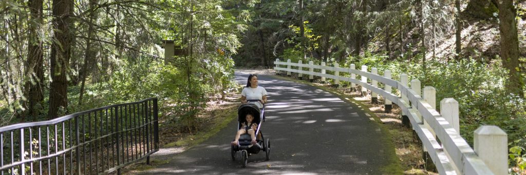
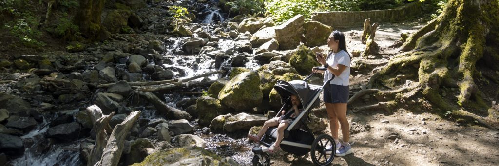
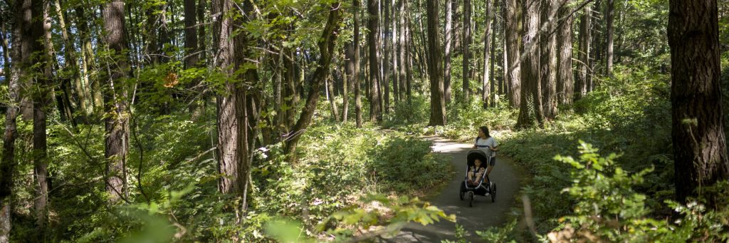
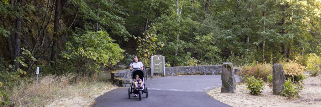
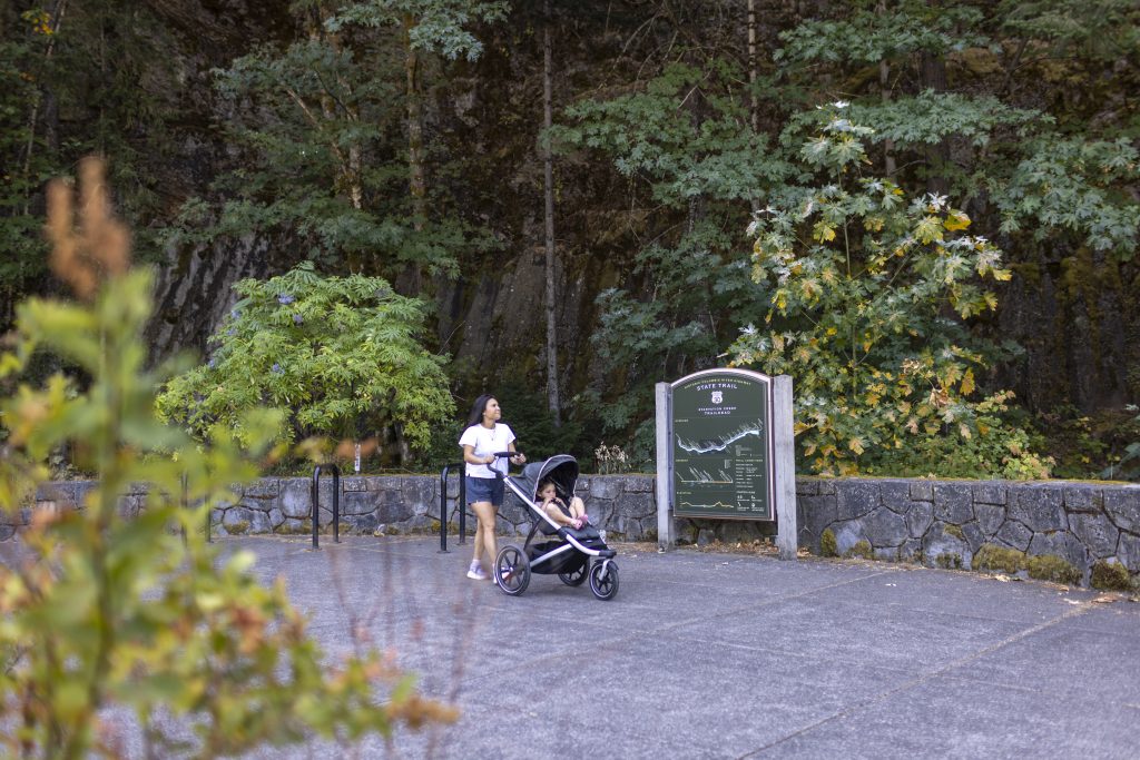
- Accessibility. Sophia Stromquist, student.Hi, I’m Sophia. I am a visually impaired person who lives here in the gorge. Starvation Creek is such an amazing trail. I’ve been on it and it’s so beautiful and I hope you’re able to appreciate it too. I love all the greenery and all the plant life and fauna you can find on the trail. It’s so amazing and it’s so cool how you can be so close to such a busy road and not even hear a thing. I am going to provide some of the basic accessibility information for this trail. Hole in the Wall Falls is a 1.4 mile round trip west from the Starvation Creek parking lot. The paved path is 12 feet wide and climbs 69 feet, mostly near the end. Along the way at 0.3 miles you can see Cabin Creek Falls from the path. The path runs along the highway which can be loud. At 0.6 miles turn left into the path for Hole in the Wall Falls. The entrance to the path is 5 feet and 3 inches and then runs 6 feet wide. At the top is a view of the falls and a picnic table. There’s an unpaved path to a bridge which is rocky and uneven. Its narrowest width is 3 feet 9 inches. The bridge is 2 feet wide with a one step.
AUDIO STORIES: STARVATION CREEK
Stop 1: In Lieu Of
In Lieu Of | Buck Jones, Columbia River Intertribal Fish Commission
Yeah, my name is Buck Jones. I’m an enrolled Cayuse tribal member, one of the bands of the Confederated Tribes of the Umatilla Indian Reservation, and for the past 21 years, I’ve been employed with the Columbia River Intertribal Fish Commission. When the first dam started in the 1930s, the dams flooded our traditional fishing sites and some of our villages.
So the government promised that they would rebuild and they would find these sites, find sites to replace those sites that was flooded. The government did keep its word, but it only took them 50 years to uphold that promise that they would rebuild those sites. So there was originally five in-lieu sites, you know, in lieu of us flooding your traditional villages and your fishing sites, they found some land.
And it was a work between, you know, the government, the U.S. Army Corps, the Bureau of Indian Affairs, and the tribes. And so they originally had five in-lieu sites, and those in-lieu sites being at Cascade Locks, at Fort Raines, and at Wind River, Cook’s Landing, and Lone Pine. Two of those sites in Oregon, on the Oregon side, and the other three are in Washington.
And so they built these sites, and then throughout the years they identified more land for more access sites. Because our fishing area is now what’s called Zone 6, and I mentioned the dams. So they start at Bonneville Dam and go all the way up to McNary Dam.
That’s considered Zone 6, you know, the fishing, the river is identified in areas starting at the estuary, at the mouth, that’s like Zone 1. And as you move up the river, you know, 1, 2, 3, 4, and then when you get to Bonneville, that’s Zone 6. So that’s our reserved area for any kind of commercial fishing that is done there. It’s only done by the tribes. You know, there’s sport fishing that’s done by the non-tribal in both states of Oregon and Washington.
But the same groups that I mentioned identified some different lands throughout that Zone 6 fishery, and came up with an additional 28 sites that became, the first ones was Inlew sites, and then the remaining are called treaty fishing access sites. And a little bit about those sites, that there is a, usually there’s, at some of the lower river sites, there’s communal restrooms and showers that they have. And then there’s usually a fish cleaning station, net racks to repair nets, some camping.
There’s usually water access to the river, and actually potable water that they drink. And then as you move up farther up the river, there may be not as many amenities. There may only be, you know, access to the river, and, you know, maybe an outdoor toilet, and some camping slip areas.
So this was really built for seasonal use. But a lot of our tribal members that now live, now kind of live on those year-round, and I think this is a two-fold kind of process, that the reasonings for that. I think that one of the main reasons is that a lot of these tribal members, this is where their family is from.
This is where their lifeline is. You know, it is the Columbia River. They’ve had family members, like I mentioned, that have been on the river, you know, fishing their whole lives.
And this is where they are from. Even though they may be a member of a tribe, you know, of our member tribes, and those four-member tribes are, you know, Confederated Tribes, Umatilla, Warm Springs in Oregon, Yakama Nation in Washington State, and then the Nez Perce Tribe in Idaho. And even though they are a member of the tribe, you know, they want to be here.
This is where they want to be or whatever. So they’ve kind of stayed at these sites. And I think another, the second part of that is that the affordable housing in the Columbia River Gorge is, there is no affordable housing.
You know, it’s a society kind of an issue too, you know, because like if you find an affordable housing, it is really, really, really difficult, you know. So that has been kind of a reason. Another reason is where they, now these sites have been lived in pretty much year round or whatever.
And, you know, there’s the conditions ain’t really the best sometimes, you know, but our people are, this is where, like I said, they prefer to be. And, you know, that’s kind of the history that on those treaty, in lieu and treaty fishing access sites.
Stop 2: First Scenic Highway in the US
First Scenic Highway in the U.S. | Bob Hadlow, Oregon Department of Transportation
My name is Robert Hadlow. I’m the Senior Historian with the Oregon Department of Transportation, which is also known as ODOT. I’ve been researching and writing about the historic Columbia River Highway for over 30 years.
What makes the historic Columbia River Highway significant is it’s the first scenic highway in the United States. ODOT demonstrated that in the late 1990s when we prepared a National Historic Landmark nomination for the historic Columbia River Highway, and one of the requirements there was to be able to prove that assertion. Comparing this highway with other scenic highways in the country, this was the first.
It set the stage for essentially what became the standards that the National Park Service used in creating its park roads, what they call a lying lightly on the land philosophy for roadway design. You have roads that are designed to high engineering standards, but not mar the natural landscape. We see this in Glacier Park and Yosemite and other parks, especially in the West, but not just there.
The Blue Ridge Parkway and Skyline Drive in the East are other examples. Ours was the first. What’s marring the landscape? The worry was that roads would just come up the side of a cliff face, and it would just be very obvious that it was there, and it would contrast so much with the landscape around it.
With a scenic highway, you want high engineering standards. That’s one of the points of building it, but also to integrate it into the landscape. Out in Columbia River, for example, we have nature’s landscape, nature’s masonry, and then alongside of that, along the highway, we have masonry made by human hands out of the same materials.
In some ways, it’s visually subordinate in that way. There are parts that stand out. The bridges, they’re made out of concrete.
They may be very white, but they’re the exception. That was the philosophy at the time. Part of the design of these bridges was the magnificent architecture and artistry in these bridges, too.
But they complement in one sense. They’re not subordinate, but they complement the natural landscape. A natural landscape includes a human-made landscape using natural materials, like the masonry walls, the guard walls, and the retaining walls down below the roadway to hold them up.
That’s what they used in those days, and we continued that. The National Parks Service continued on in the 1930s. They actually published a book about essentially the National Parks Service rustic type of architecture that included roadways and buildings and other structures that one might see in the parks.
Stop 3: 3 Weeks in an Avalanche
Three Weeks in an Avalanche | Randi Mendoza, formerly with Oregon State Parks
My name is Randi Mendoza. When I was an interpretive ranger for Oregon State Parks, in my work I accumulated many favorite stories, and today I’d like to share one that has been special to me. The story of Starvation Creek as told by Colonel L.S. Hallett.
Many are familiar with the general story of this place. In 1884, a Union Pacific train carrying passengers west of Portland was trapped by an avalanche for three long cold weeks over the Christmas holidays. With limited food and challenges accessing the train in the snow, passengers struggled to survive the elements while waiting for supplies and rescue.
Thankfully, everyone survived the ordeal, although gossip and rumors of passengers succumbing to starvation persisted in the surrounding communities. The creek continues to be called Starvation to this day. In mid-summer of 2020, I was off in deep diving into Columbia Gorge history as a means of distraction from the changes and challenges many were experiencing during the pandemic.
I, in my diggings, stumbled across an 1885 Oregon Sentinel newspaper featuring Colonel Hallett’s account of being snowed in at starvation. I was initially excited to simply have a detailed first-hand day-by-day account of his story. However, I soon discovered the real treasure wasn’t in the hard facts but in the sentiment in which he told his story.
Hallett wrote at the end of his piece, these daily jottings in the life of an exile undergoing an entirely new experience will teach others how much can be endured when a cracker is a blessing, a potato a luxury, and when there’s nothing warm except human sympathy and nothing light but hope and a tallow candle. As I read through a summary of each day, I noticed that he never downplayed the dire situation they were experiencing. It also wasn’t the highlight of his entry.
Instead, he seemed to capture the humanity of the individuals coming together, overcoming fear in a challenging situation. From the men who tracked miles through the snow from neighboring towns bringing food and medicine, to the passengers who utilized their skills and strengths to free the train and provide comfort to others, to the many ways they created their own light and joy even while trapped over Christmas and New Year’s, the story reveals extraordinary resilience. He shares in the memory of cozy homes the present is forgotten.
With everything going on in the world, I often felt trapped and uncertain about the future. It was easy to give in to rumination and anxiety over things outside of my control. In a time of change and uncertainty, Hallett’s approach to the ordeal with curiosity, introspection, and a sense of adventure reminded me that even in dark times there is light and that fear of the unknown softens when people come together to bear the weight with empathy, compassion, and resilience.
I hope this story inspires you as you explore our Starvation Creek. Thank you for listening.
Stop 4: Sit at the River
Sit at the River | Marcus Lattimore, Poet
It’s not even a choice at this point to go and sit by the river. The gurgle over pebbles is the sound that I surrender, calming every thought in the quantum of my physics. No aspirations, just being in existence.
Spiderweb dangles red-brown crunchy leaf. Teardrops from the heavens roll down my cheek, sense the mystique as the caterpillar wiggles. The gurgle that I’m hearing has now turned into a trickle, releasing fresh waters that I held within my path.
Nutrients for fish that will swim into my path. Lime green moss with the toad in meditation as Estella J celebrates our newest revelation. Patience, patience, there’s no need to race it.
Roll with the twists and the turns and the curves. In this moment, there’s a chipmunk ruffling through the ferns. Searching for a something that will force my head to turn, I have learned there’s a preacher in the gospel of the force.
And if we are to listen, there’s a teaching that’s enormous. Sources of hydration spill from a natural geyser. Drinking from this wellspring alleviates the fire.
You will soar higher until you reach a plane, where flowing in the breeze becomes the meaning of your name. I used to think that fame and money would bring contentment, but now I just sit at the water and just listen. Sit at the water and just listen.
Now I just sit at the water and just listen.
My name is Marcus Lattimore and I’m a writer, poet, and wellness director at Zen M and M. You can find me on Instagram, I’m pretty active on there, at MarcusLattimore underscore.
Stop 5: Exit 55
Exit 55 |Marcus Lattimore, Poet
Poem, free or exit 55, here we go.
Time dwindles away when one becomes encumbered by awe, her beauty unexplainable, yet satisfying. When present in God’s presence, your feet stop, your knees drop, your mind sits still for once.
Your heart rushes like water to an overflow of riches that are not sufficient for the common man’s pockets, yet he is wealthier than he will ever be because in this moment, there is a force of nature that is consistent with who he wants to be, to which he belongs.
My name is Marcus Lattimore and I’m a writer, poet, and wellness director at Zen M and M. You can find me on Instagram, I’m pretty active on there, at MarcusLattimore underscore.
Stop 6: The Last Mile and a Half
The Last Mile and A Half | Bob Hadlow, ODOT Historian
My name is Robert Hadlow. I’m the Senior Historian with the Oregon Department of Transportation, which is also known as ODOT. I’ve been researching and writing about the historic Columbia River Highway for over 30 years.
We have about a mile and a half to go to complete the state trail between Trapdale and the Dalles, and at that point someone will be able to get on a bicycle in Portland and ride on roads at everything but the interstate highway shoulder from Portland to the Dalles, and that will make the historic Columbia River Highway and the state trail a world-class destination for tourism. So on the drivable sections, they’re good places for people who don’t mind riding bicycles with automobiles because it’s not the interstate. But then there are sections, then there’s these gaps that we’ve created, a state trail, this historic state trail by connecting little bits and pieces of the highway, or in this or in the section between Hood River and Mosier, there’s a long section there that had been closed, including the Mosier Twin Tunnels, and that was one of the first that ODOT and its partners rehabilitated, and that included cleaning out the tunnels and creating some rock catch structures there to make them safe.
It wouldn’t have been safe for people to ride, and that all of a sudden became very popular. It’s a long section, four and a half miles, where you don’t have to worry about cars and you can ride your bike and walk and stroll with your kids and do some rollerblading and what have you, and it’s a very safe environment for that. So the people who are okay with riding their bikes along the shoulders on the drivable portions, of course they’re going to ride those too.
So for those folks, once this last trail segment is completed, they’ll have a whole route to ride from Troutdale to the Dalles and back.
Stop 7: Tail of Two Floods
Tale of Two Floods | Dr. Scott Burns, Portland State University
Scott Burns, Professor Emeritus of Geology at Portland State University. In geology, my specialties are quaternary geology and geomorphology, and then study of the Missoula Flats. The Columbia River Gorge is from the Columbia River, and the Columbia River has been flowing for the last 20 million years and has been emptying into the ocean and we get deposits from that all the way from Newport, Oregon, all the way up to Willapa Bay, Washington.
But we know that the Columbia River Gorge has been around for a long time, and the Columbia River has been flowing through it. And as the mountains are uplifting, the river is downcutting. And so you’ve got the incredible gorge that we have got.
So the story of the Columbia Gorge, Tale of Two Floods. The first floods were the Columbia River basalts. The second one were the Missoula floods that you have got.
So the majority of the rock that is found in the gorge is basalt. It’s a black rock. It’s volcanic.
But where did it come out of the ground? It came out where Oregon, Washington, and Idaho come together. And it was very similar to the volcanoes that you have on the Big Island of Hawaii. Not explosive, just big cracks in the ground, magma coming out and then flowing.
Up in southeastern Washington, you have maybe 20 to 30 flows, one on top of another, over 1,000 feet thick of basalt. As you come down the gorge, you can still, like in Multnomah Falls, you have six or seven major flows that are there, one on top of another. All of that basalt coming out of the ground where the three states come together.
Columbia River basalt is just a huge eruption. Started about 17 million years ago, ending about 10 million years ago, with the majority of it coming out between 16 and 14 million years ago, one flow on top of another. When I take people up the gorge, geology, I say it’s a tale of two flows.
The first one, the basalt flows, over 300 different basalt flows forming the Columbia River basalts. And the second floods that you have got are the Missoula floods. And all of those basalt flows, many of them made it all the way down to the Oregon coast, Cascade Head, Yaquinda Head, Cape Lookout, are all flows that came across the state.
Now, the Missoula floods came down, it was 15 to 20,000 years ago, all of these Missoula floods came down, and they filled up the valley. They filled it up to like 400 or 500 feet elevation. And so, they scoured out the valley, and then as the water levels went down, you had deposits that were formed.
But the valley has been scoured out. The big picture is the two different floods, the floods of the basalts, and then the Missoula floods, the 40 different floods that came down. And then, Starvation Creek and all of the creeks coming in are all more recent, since the Missoula floods were there.
Stop 8: Pizza on the Side of the Highway
Pizza on the Side of the Highway | Elika Paki, Oregon State Parks
Aloha, this is Ranger Elika.
More than a hundred years ago, long before the roar of traffic along Interstate 84, this canyon sounded very different. Imagine the Columbia River Gorge with no freight trains, no barges, and no lines of semi-trucks—just wind, water, and the ringing sound of hammers striking stone.
When engineers began building the Historic Columbia River Highway in the early 1900s, they needed skilled stone masons. Many came from Italy—men whose families had worked stone for generations. Others were local craftsmen from Portland. Together they formed crews that shaped the road you’re standing beside today.
Their work was incredibly hard. They quarried basalt directly from these cliffs, breaking it loose by hand and shaping each piece to fit perfectly into the retaining walls and guardrails that still line the highway. Day after day they labored in the wilderness, far from home, carving a road through one of the wildest landscapes in Oregon.
At night, when the tools were finally set down, these masons gathered at their camps. To bring a little piece of home with them, they built small stone ovens—right from the same basalt they used on the road. Inside those ovens they baked bread and shared hot meals after long days of work.
Just off the trail, beyond this fence, one of those ovens still stands today—quiet, weathered, covered in moss, and more than a century old. It’s a reminder that behind every stone in this highway is the story of the hands that placed it.
Stop 9: Different Everytime
Different Everytime | Martine Sacks, Avid Biker
Hi, my name is Martine and I like to ride my bike. This is a start of one of the places where we take a lot of people on bikes. I love this particular part of the gorge because you get a little bit of everything.
There are waterfalls, there are hills, there’s forest, there’s bridges, and you get to see the river. You get a smattering of all that’s beautiful about the gorge. This path is part of the original highway that was built in 1916 and this highway was built for people to experience the gorge not to go from point A to point B and that’s still what’s really great about being in the gorge and on this path.
You’re not biking to something, you’re biking so you can be in the gorge and experience it. Every time I come, no matter the season, and we’re here all different seasons, it’s different. There are different flowers, there’s snow, there’s ice, there’s an otter walking across the pathway.
You get a different experience every time. I will note that a friend of mine says that it’s uphill both ways and that’s what the gorge is like. It was not built like a rail trail that’s meant to be flat.
It’s built so that you’re in the land and following the geology along the river. I wrote a poem about biking here a few years ago which I’ll share. It really was about biking west from Cascade Locks but it’s the same principle.
I’ve been on this ride before but somehow I didn’t remember how much up and down there was. In the beginning, I was sailing downhill. I would find myself thinking about how hard that hill would be on the way back.
Each action has an equal and opposite reaction. Every downhill is an uphill on the way back. At some point, I let go of marking the spots where the hills changed.
Once you reach the transformer, it will be uphill again. I stopped worrying about what was ahead. As I was struggling to pedal up, I started to look around me.
Miners, lettuce, flocks, fiddleheads, shoots that I call wild asparagus but have no idea what they really are. I hadn’t noticed them on the way out. I even walked for a while.
There is no shame in that, I thought. At the rare moments of flat, I would get back on my bike and pedal slowly, more slowly than at the start of the ride. A mile at the end of the day is not the same as a mile at the beginning of the day.
I would speed down the hills. I shouted, hello, hello, hello and rang my bell as I went through the tunnel. And even though I was tired and hot and grumpy and sore, I biked up that last hill thinking, why it’s not as bad as I thought.
So that for me is what biking in the gorge is about. It’s a lovely experience to be in the land and of the land. You see the world so differently on a bike, even more different than when you’re walking.
You get a grander scope through your peripheral vision. You see a panorama and you feel like you’re really where you are. You also get to stop whenever you want to stop and we stop a lot for photographs or to enjoy the waterfall or to catch our breath or for lunch.
And right now we’re going to have some lunch. Thanks for coming.
Stop 10: Hole in the Wall Falls
Hole in the Wall Falls | Marcus Lattimore, Poet
How many eyes have gazed at your endless pour? How many ears have heard your soothing roar? How many boots have stood where we now stand? How many drops of rain have joined your band? How many tongues have been spoken in your space? How many fingers have felt your cool embrace? How many dreams have been casted in your well? How many hearts have been broken out of their shells?
My name is Marcus Lattimore and I’m a writer, poet, and wellness director at Zen M and M. You can find me on Instagram, I’m pretty active on there, at MarcusLattimore underscore.
Trail Safety Text
Trail Safety | ReadySetGorge.com
Stay on the trail
Mind the poison oak
And ticks along the way
Don’t want to provoke
Stay on the path
To keep those species at bay
They cling to your shoes
Don’t let them stray
Welcome to the gorge trails
Say hello to all,
wag those tails
Because everyone is welcome on our Gorge trails
Keep your dogs on the track
For the same said reasons
Let’s protect this place
Through all the seasons
Leave the flowers be
Just take memories home
Photos in your heart
Or on your phone
Welcome to the gorge trails
Say hello to all,
wag those tails
Because everyone is welcome on our Gorge trails
This place is unique
No other alike
Stop by the next town
For a drink or a bite
They say leave no trace
Pack it in, pack it out
Or simply put
Take care on your route
Welcome to the gorge trails
Say hello to all,
wag those tails
Because everyone is welcome on our Gorge trails